Surprise Derecho rakes across northern maryland 4/
Late Saturday night, a cluster of very intense severe thunderstorms raced across western and northern MD from Garrett county all the way to Cecil county leaving a path of widespread wind damage, and wind gusts measured in excess of 100mph. The storm caught everyone off guard due to its rapid forward speed as well as the fact that the chance for rain that night was very low.
Radar Progression:
The storms entered far western MD around 8:30pm as a well defined bow echo. The storm rapidly progressed eastward through the MD panhandle producing 65-75mph wind gust and widespread wind damage to trees and powerlines. By 9:30pm, the bow echo entered Washington county and began intensifying as a rear inflow jet developed. Significant damage was reported especially in Hagerstown, and a 105mph wind gust was recoded on a weather station in Maugansville. The storms continued to race east across Frederick and Carroll counties.
At Camp David, an 81mph wind gust was recorded which prompted a destructive tagged severe thunderstorm warning. One thing to note is that the winds were much stronger than what velocity out of KLWX showed. This is because the radar beam was parallel to the storms orientation, which makes it much more difficult to identify areas of high winds based solely on velocity. Switching to TBWI gave a better look at velocity once the storms were in range, as it was now perpendicular to the storms orientation (N->S). The storms continued at their ferocious intensity into northern Baltimore county producing more damage before they slowly began dissipating over Harford and Cecil counties.
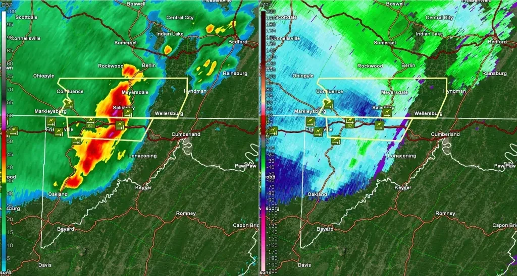
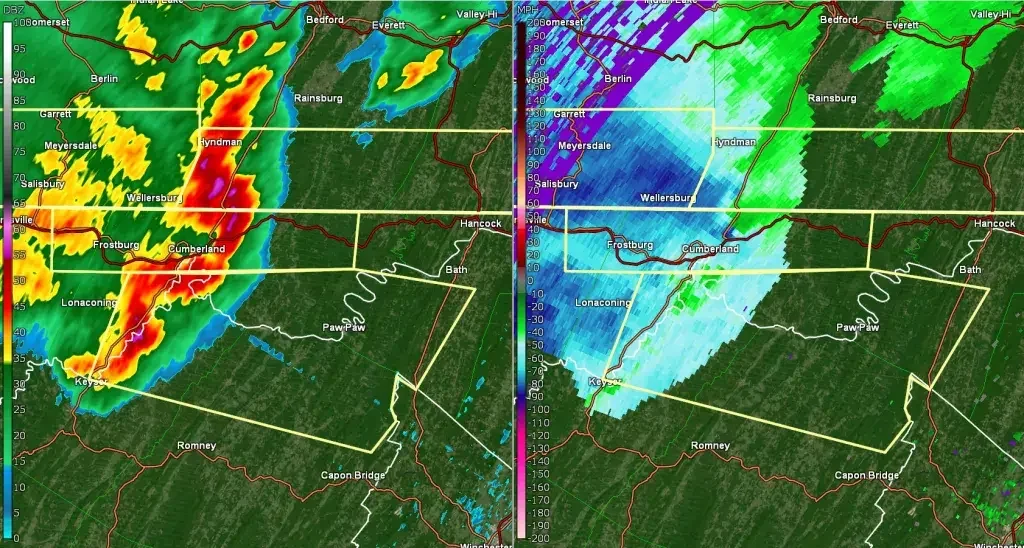
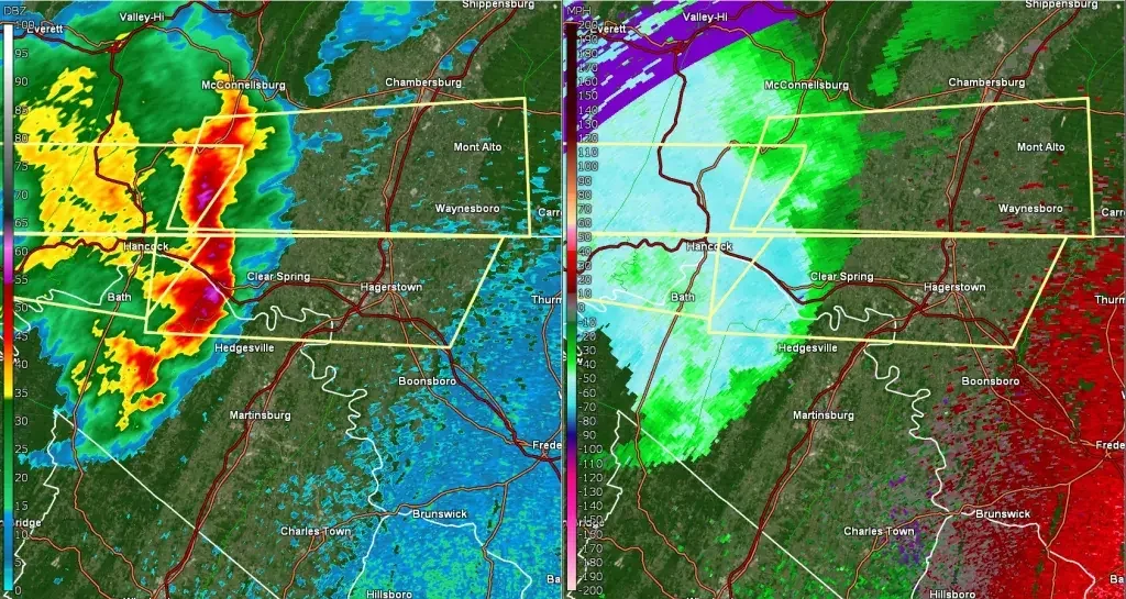
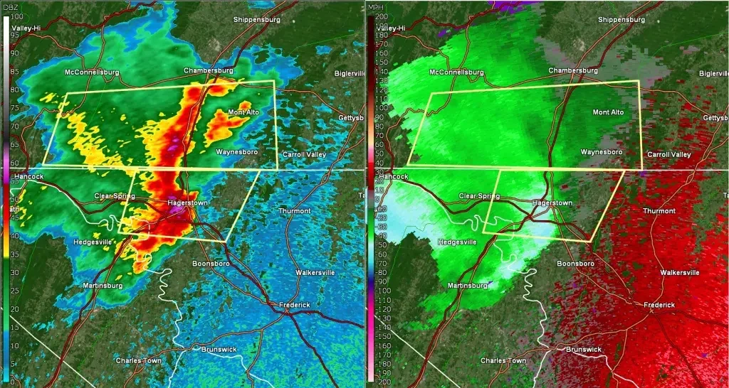
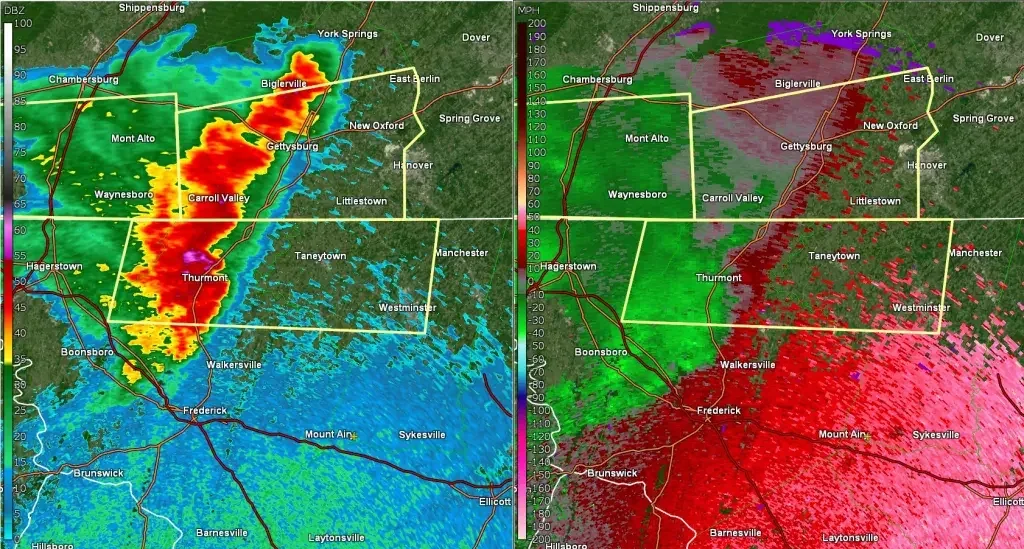
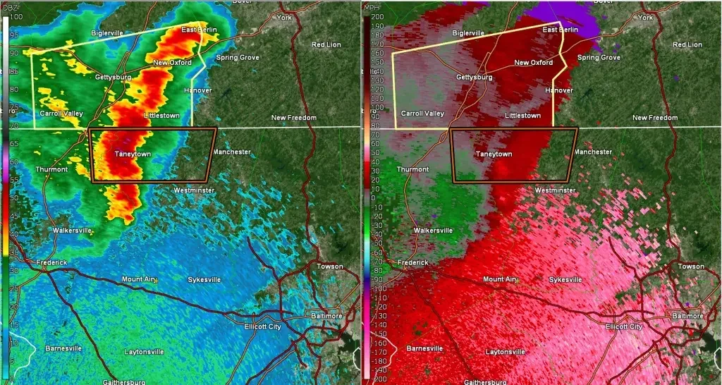
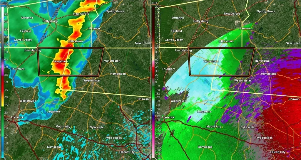
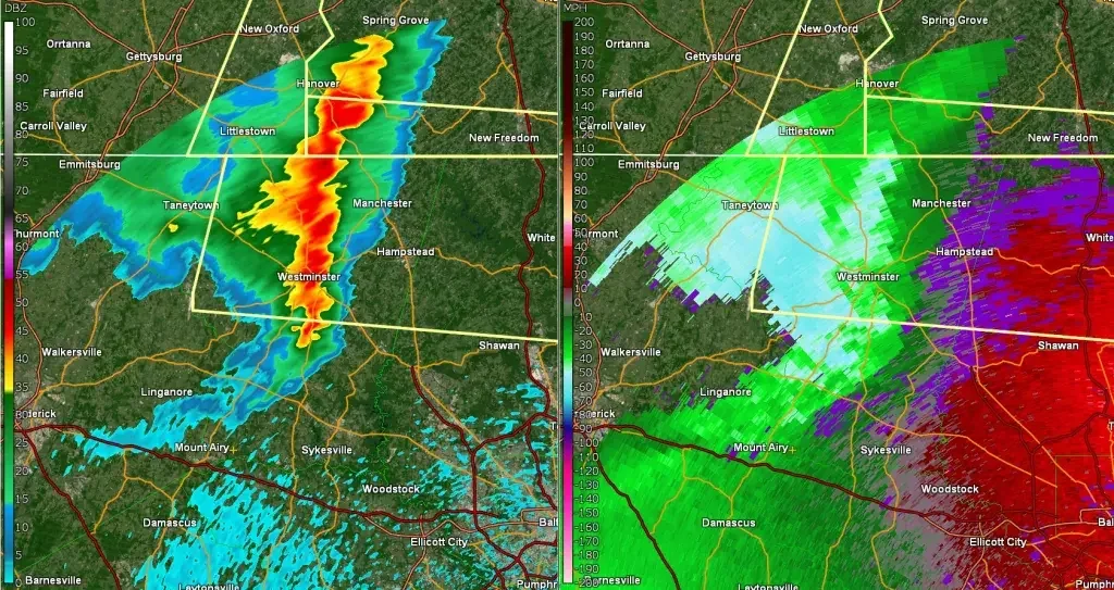
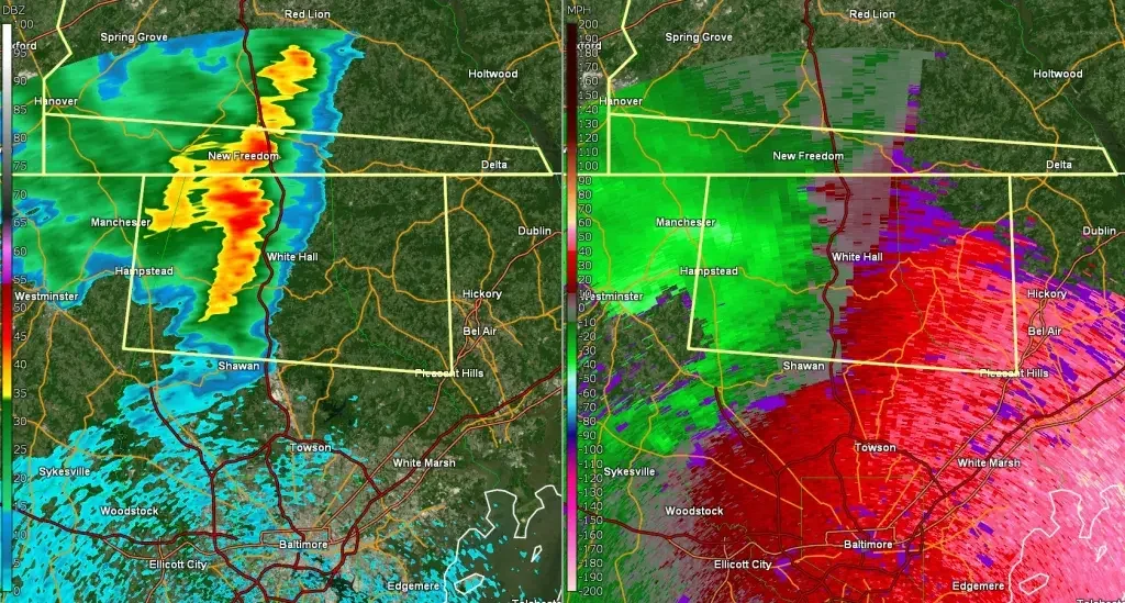
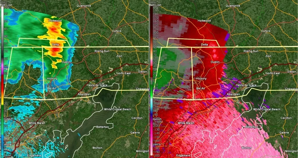
Damage reports and was this a derecho?
While fairly narrow, the damage path was extensive. Starting in the panhandle of WV and tacking all the way into northeastern MD, hundreds if not thousands of trees were blown down, with countless powerlines snapped as well. Scattered instances of structural damage also occured in Washington and Carroll counties, where roofs were blown off several structures including houses and barns, and a silo was blown down in northwestern Carroll county. Additionally, a shed was lofted and blown apart in Smithsburg.
In Hagerstown, a 75mph wind gust was recorded at the regional airport. In Maugansville, 2 separate weather stations measured wind gusts over 100mph, one reaching 103mph, and another reaching 105mph. Camp David in northwestern Frederick county measured a wind gust of 81mph. In Keymar, a weather station measured a 90mph wind gust. And in downtown Westminster, the regional airport measured a wind gust to 71mph. Even as far south as Mount airy, where the outflow passed through with no rain, winds gusted in the 40-45mph range which while not severe, just shows how wide reaching the winds were.
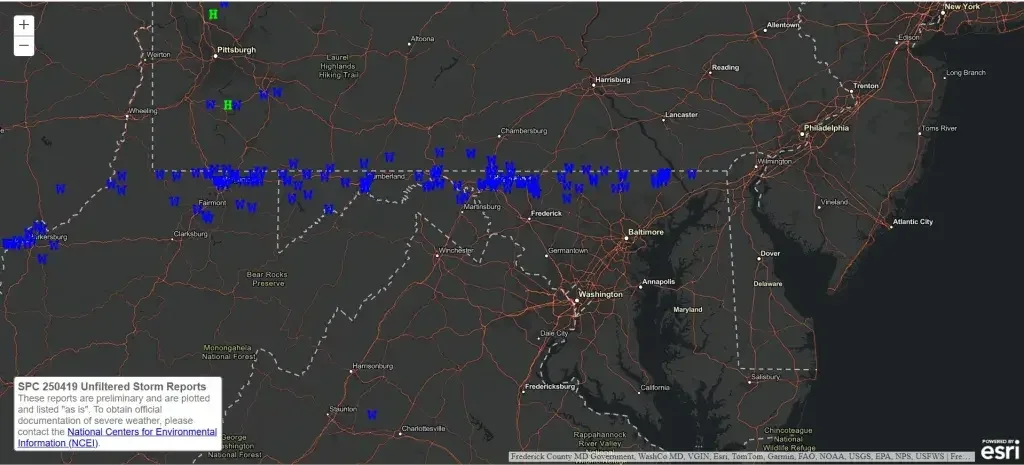
So was this a derecho? Based off of the NWS definition, the answer is yes. The NWS states that in order for a storm to qualify as a derecho, it must produce a continuous path of damage lasting at least 240 miles in length, with scattered reports of winds gusting in excess of 74mph. Both of these criteria were met with this event, and therefore it can be considered a derecho, despite its more narrow width than what you might expect with most derechos.
The Meteorology Behind It
To say this caught everyone off guard is an understatement. Looking back, there certainly was not a well defined classic severe weather environment in place across the area. However there are a few things that occured that I think helped lead to such an impactful storm.
The first is that we had exceptionally high levels of DCAPE (downdraft cape/instability) ahead of this bow echo. DCAPE is a key parameter I look for when identifying an environment that is favorable for damaging winds. Anything over 800 j/kg I consider favorable for damaging winds, and anything over 1,000 j/kg I consider favorable for significant damaging winds (greater than 70mph). Saturday night had DCAPE values well over 1,000-1,200 j/kg. So despite the fact that there was hardly any surface CAPE, and lapse rates were far from ideal, this certainly played a role in the ability for this storm to produce such high end winds.
In addition, the rapid forward motion, which at times exceeded 70mph, aided in this storms ability to track a long distance in a short amount of time even without the typical severe weather parameters we see with most derecho events. One thing that is common with derechos is the development of a rear inflow jet, and that was present with this system as well, which also helped with its maintenance along with developing a well established and deep cold pool.
Finally, weather stations immediately ahead of the outflow from this storm noticed a subtle temperature increase, mostly between 1 and 3 degrees, right before the storms arrival. This signaled increasing inflow and perhaps aided in slightly higher surface CAPE immediately ahead of the bow echo, enhancing its severe weather potential.
