On June 1st, 2012, Nearly a Dozen Tornadoes Touch Down Across Central Maryland
On June 1st 2012, an outbreak of tornadoes struck the central portion of Maryland hard, with nearly a dozen tornadoes being confirmed to have touched down. This was part of a tornado outbreak that stretched from North Carolina to Pennsylvania, with more than two dozen tornadoes occuring.
Information about the tornadoes that occured in Maryland is sparse, but I have reached out to the National Weather Service to see if they can provide any additional information.
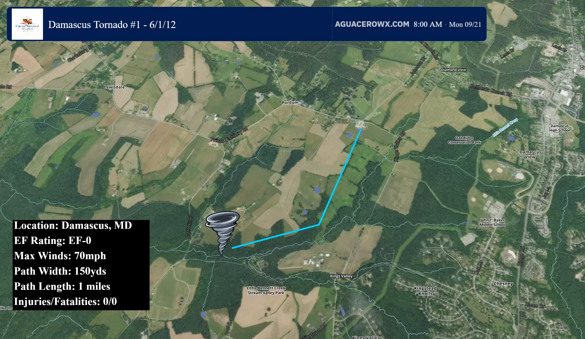
1) Damascus #1
The first tornado of the day touched down on the southwest side of Damascus in Montgomery county. The tornado was rated EF0 with maximum winds of 70mph. It was on the ground for 1 mile, and was approximately 150 yards wide.
NWS SURVEY:
A tornado uprooted nearly two dozen trees in a wooded area along western sections of Kings Valley Drive between Kingstead and Mountain View Road. The tornado produced roofing damage to a barn in the 11000 Block of Mountain View Road.
2) Poolesville
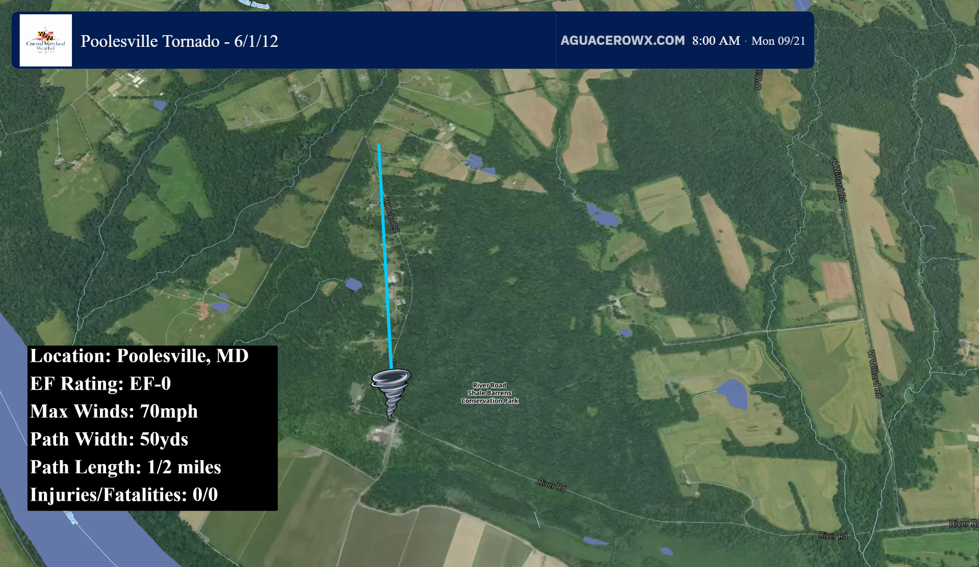
The next tornado also touched down in Montgomery County, in the town of Poolesville. This was a very brief touchdown, with the tornado being rated EF0 with maximum winds of 70mph. The tornado was just 50 yards wide, and on the ground for only a half a mile.
NWS SURVEY:
Damage was observed to about a dozen trees and a street sign on Mount Ebo Road. A video recording made at the time showed the tornado touching down where the damage occurred.
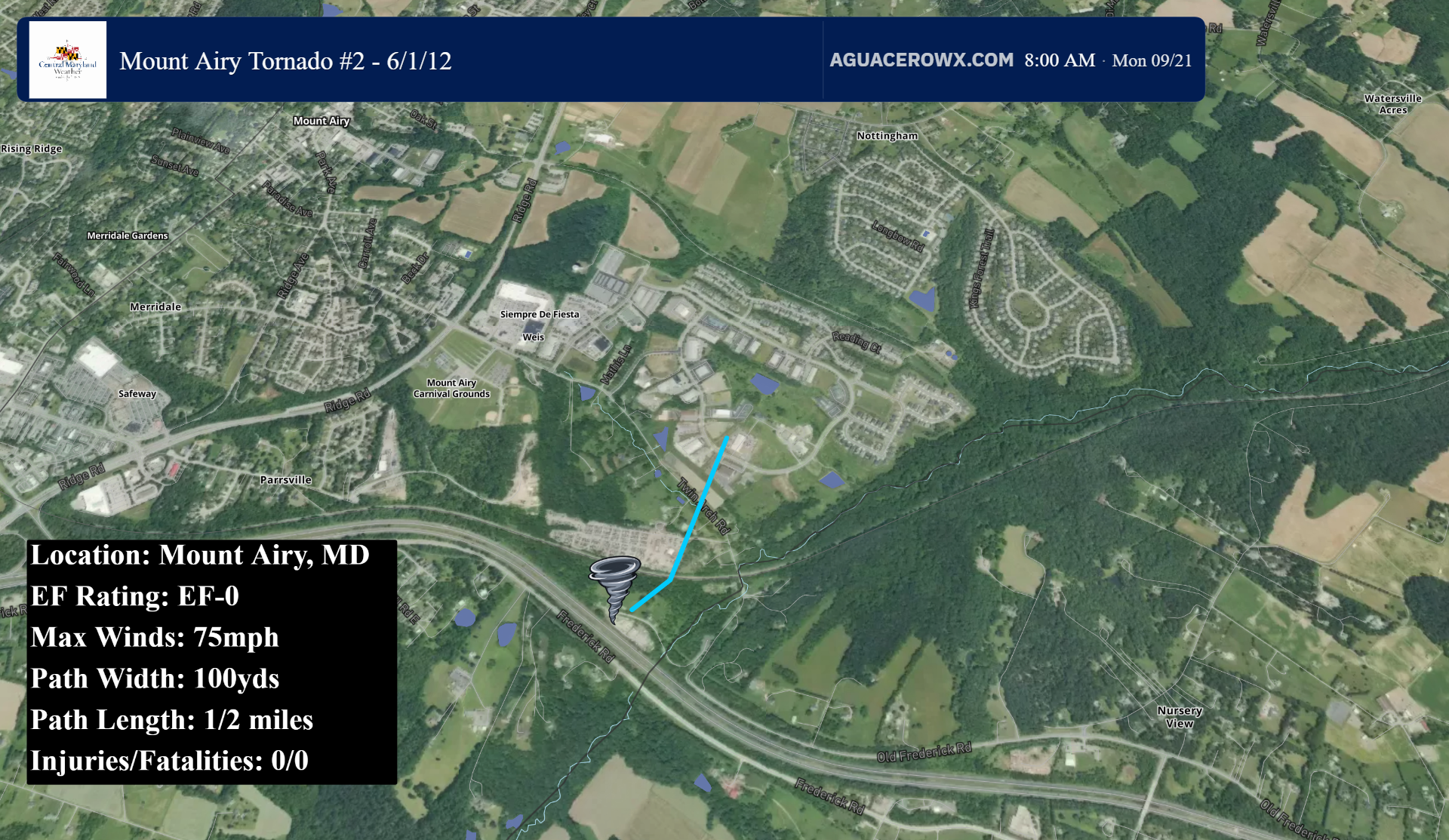
3) Mount Airy/Twin Arch
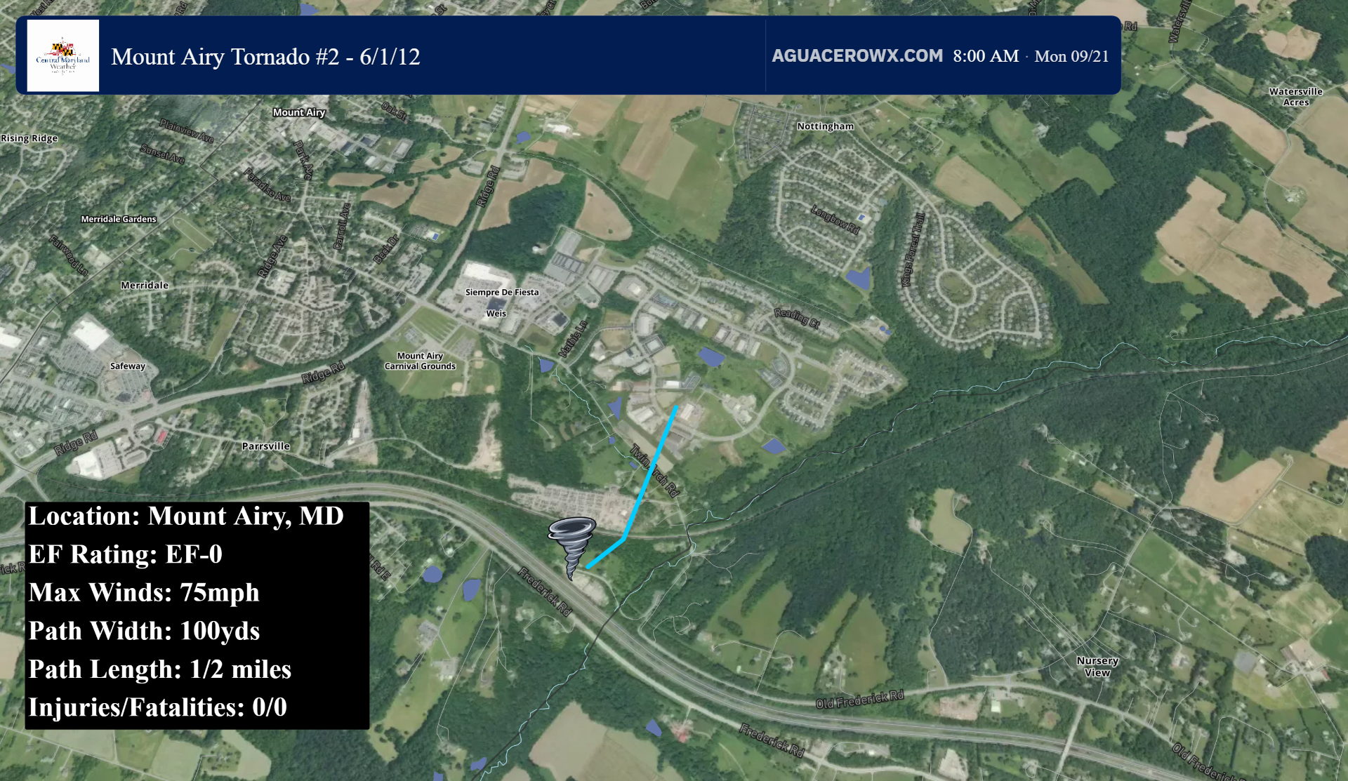
The 3rd tornado touched down in the Twin Arch area of Mount Airy. This was another EF0 tornado, with 75mph winds. It was on the ground for just under a half mile, and was 100 yards wide.
NWS SURVEY:
The tornado produced sporadic damage near Twin Arch road. There were about two dozen trees uprooted along with large limbs snapped.
4) Mount Airy/Watersville
The 4th tornado occured along Watersville Road in Mount Airy. This was an EF1 tornado, and had maximum winds of 100mph. This tornado was on the ground for 1.4 miles, and was 200 yards wide.
NWS SURVEY:
Initial tornado damage occurred to trees along west Watersville Road just north of Old Frederick Road. The tornado tracked northeast across a large wooded area of West Watersville Road where a swath of large Hardwood trees were either snapped or uprooted.
An area of intense damage consistent with EF-1 level winds was noted in the 500 Block of West Watersville Road where 30 to 40 large Hardwood trees up to two feet in diameter were uprooted or snapped twenty feet up. The tornado dissipated at the intersection of Watersville Road and Flagmarsh Road near Honeybush Drive.
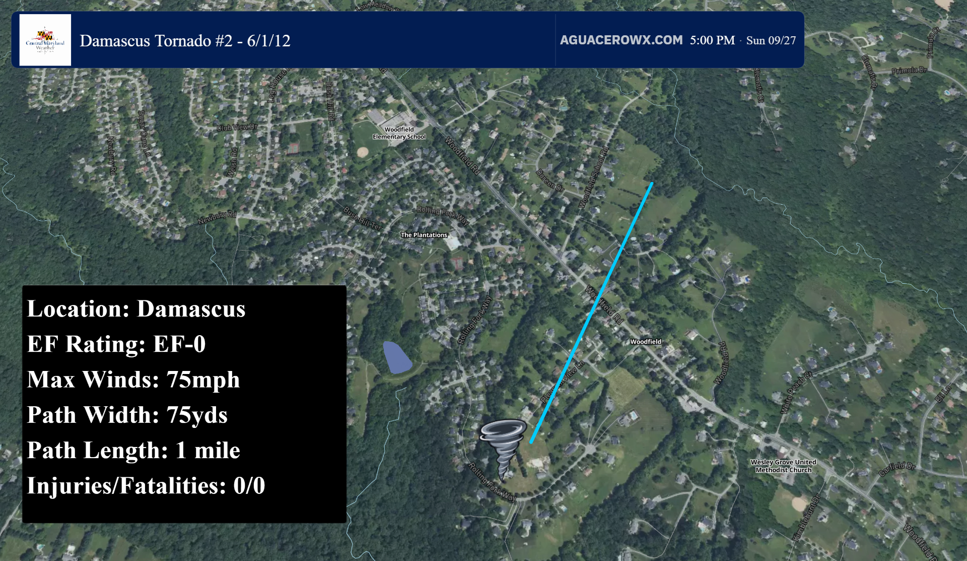
5) Damascus #2
The next tornado to occur yet again touched down in Montgomery county, just to the east of Damascus. This was another EF0 tornado, with winds around 75mph. It was on the ground for 1 mile, and was 75 yards wide.
NWS SURVEY:
The tornado caused tree damage along Pleasant View Lane. Some shingles were blown off house roofs and trees fell onto several homes and power lines. A house in the 23700 Block of Woodfield Road had minor damage to its eaves on the northeast-facing side.
The tornado caused tree damage and minor structure damage to one home along Echo Creek Court.
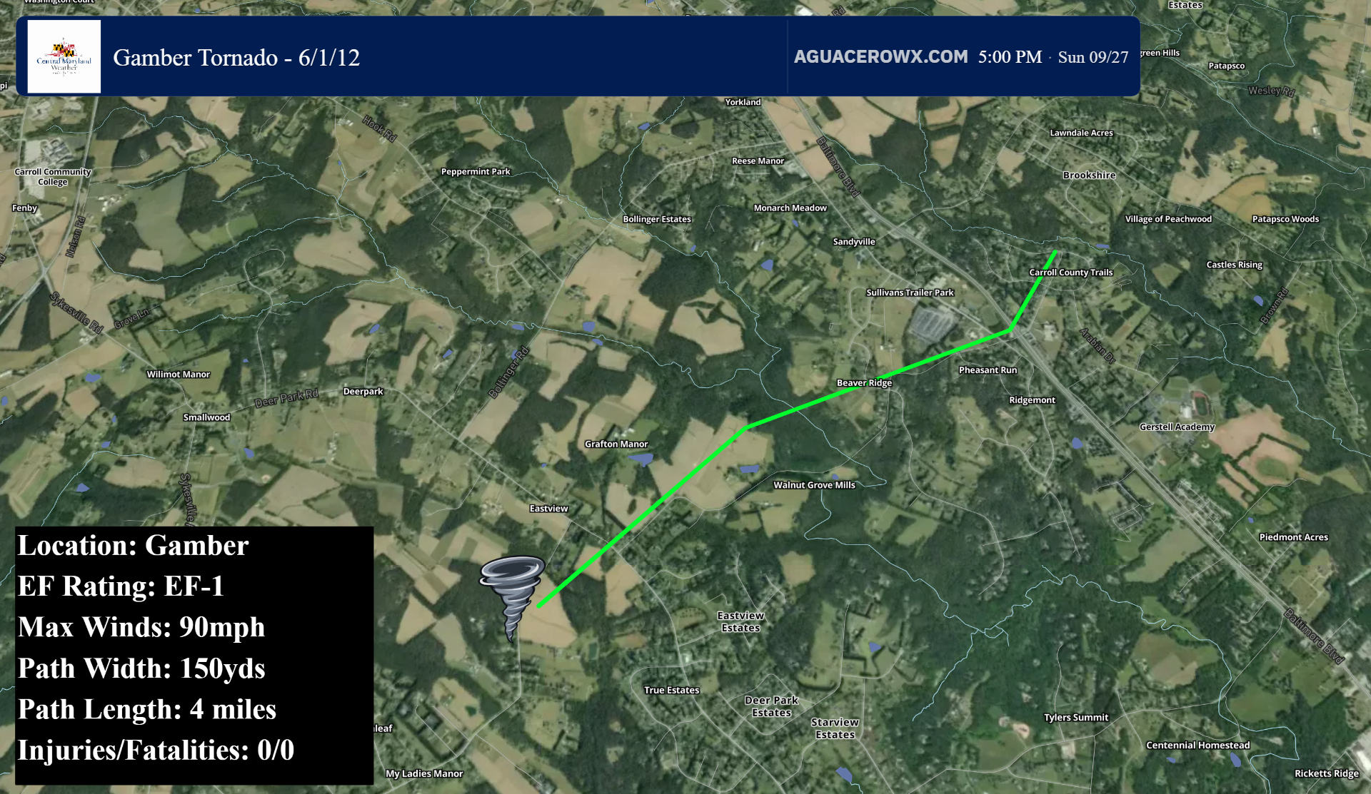
6) Gamber
The sixth tornado touched down in Gamber in east-central Carroll County. This tornado was rated EF1 with 90mph estimated maximum winds, a path width of 150 yards, and was on the ground for 4 miles.
NWS SURVEY:
The tornado snapped and uprooted several trees along the 2600 Block of Bird View Road. The most concentrated damage was focused along and north off Green Mill Road where numerous hardwood trees were uprooted and snapped, with some tree trunk diameters in excess of two feet. A tree fell onto a house, leaving that residence uninhabitable.
The tornado tracked across MD State Route 140, after passing near the Finksburg Library, producing scattered tree damage.
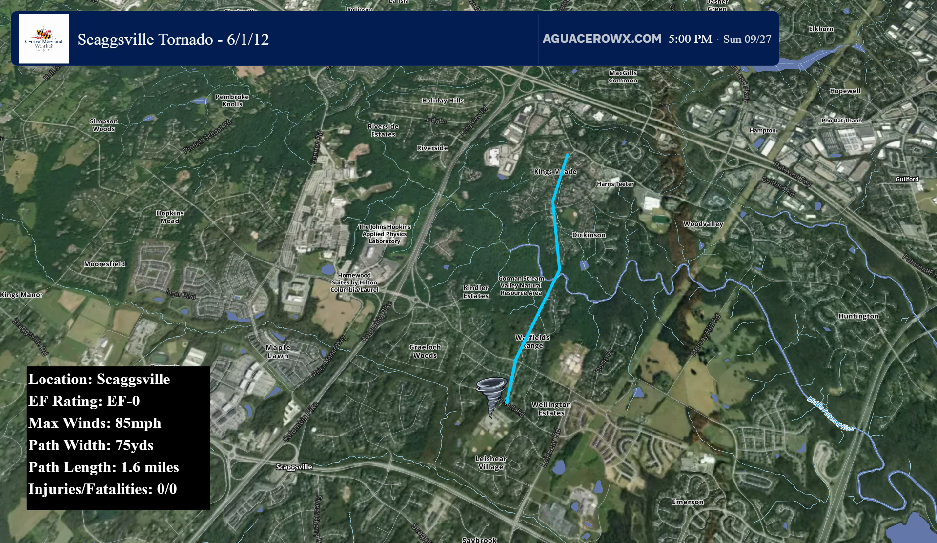
7) Scaggsville
The next tornado occured in Scaggsville, which is in southern Howard County. This was an EF0 tornado with 85mph winds. This tornado was on the ground for 1.6 miles, and was 75 yards wide.
NWS SURVEY:
The tornado topped a few trees in a neighborhood just north of Hammond Middle School and south of the 10500 Block of Gorman Road.
The tornado uprooted and topped trees at the end of Broad Cloth Way. The most intense damage was in the 7400 Block of Weather Worn Way near the intersection with Eden Brook Drive, where about two dozen mature hardwood trees were uprooted and snapped behind two homes. There was roof damage to a house after a large tree fell onto it, and another home across from a Day Care Center on Eden Brook had its chimney blown over.
After passing north of Eden Brook Driver near First League, tornado damage was more intermittent, with several trees topped. One large limb fell on a house on Kindler Road at Single Wheel Path. The tornado lifted before crossing Route 32. An eyewitness on Route 32 near Interstate 95 approximately two miles away observed the tornado just before it lifted.
NOTE: While the official NWS survey indicates EF0 intensity, the snapping and uprooting of 2 dozen hardwood trees is more indicative of an EF1 tornado, perhaps with winds around 100mph. However, this is just my opinion, not official NWS information.
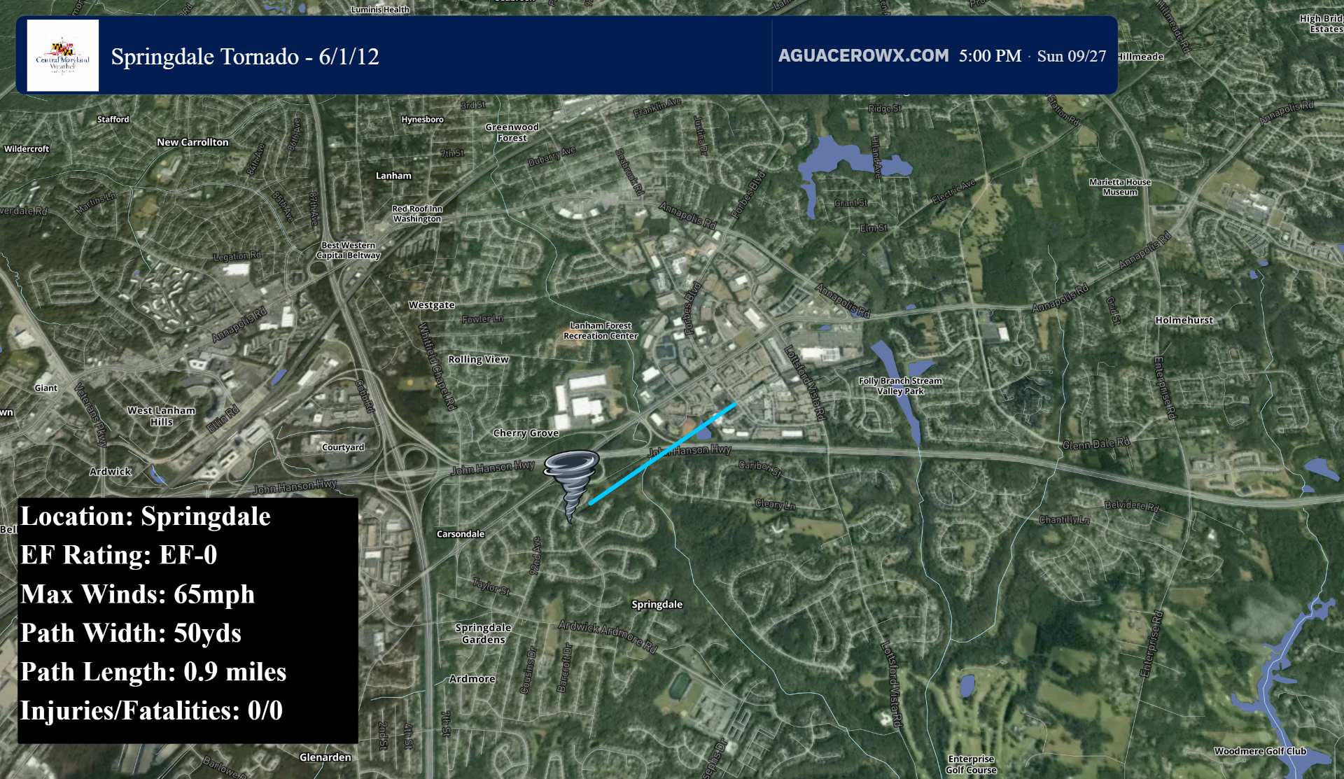
8) Springdale
Another tornado touched down in Prince Georges county near the town of Springdale. This was a very brief EF0 with the path length only lasting 0.9 miles, with a width of 50 yards. The tornado had winds of 65mph.
NWS SURVEY:
A short narrow damage path was encountered between Meadowhill Road and Forbes Boulevard, consisting of spotty tree damage. The debris field exhibited evidence of cyclonic curvature consistent with a weak EF-0 tornado.
9) Patuxent Wildlife Refuge
The next tornado touched down in the Patuxent Wildlife Refuge. This was also a low end EF0 with 65mph winds. It was on the ground for just 0.2 miles, and was 75 yards wide. There is very little information on this tornado, and no path map could be constructed based on the available information.
NWS SURVEY:
Damage consisted entirely of uprooted and snapped healthy trees along a brief and concentrated path that began near Lemon Bridge Road and Wildlife Loop South and ended near South Road and Wildlife South. In this portion of the forest, several trees were uprooted or snapped, with other adjacent trees exhibiting snapped limbs.
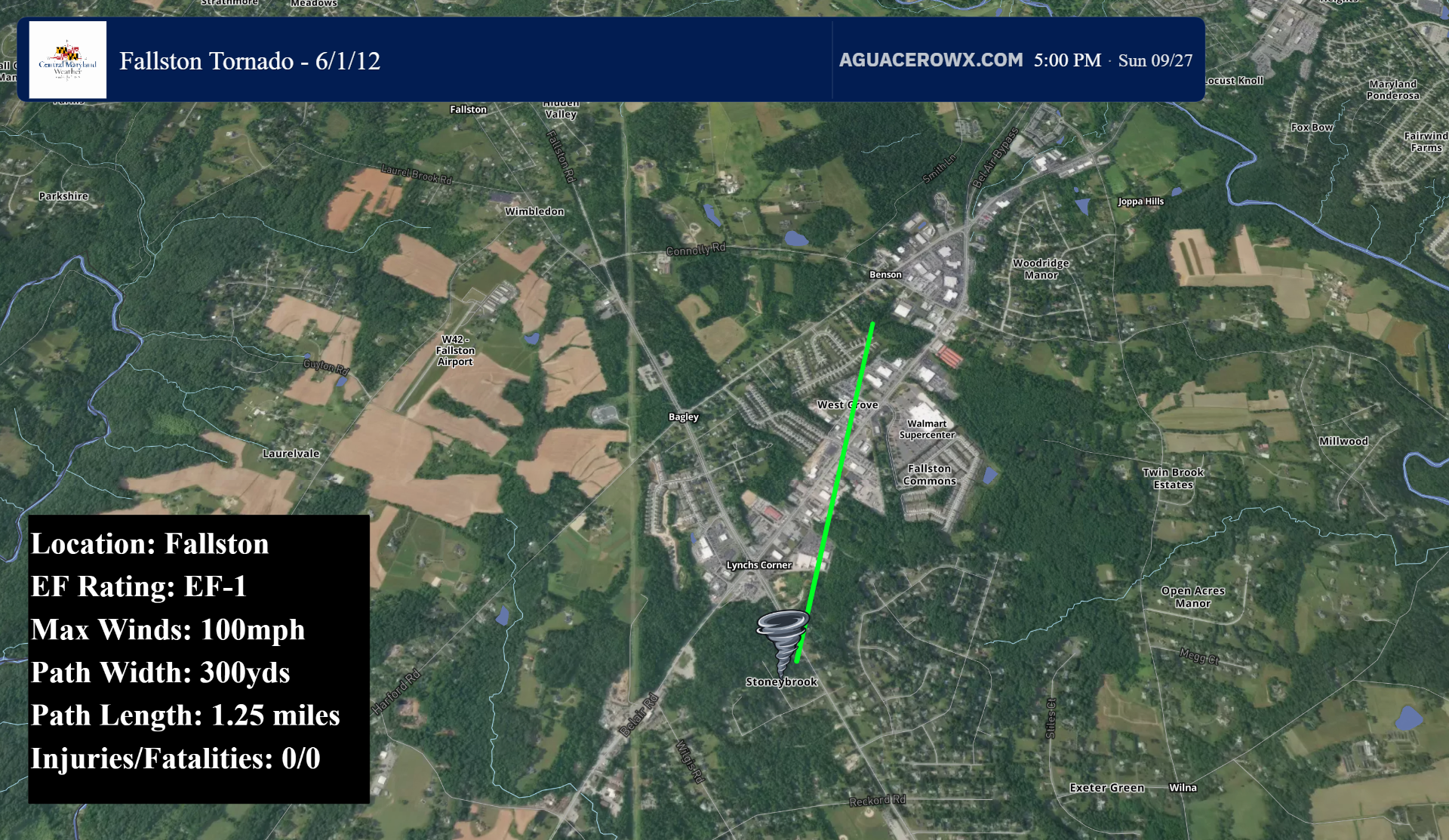
10) Fallston
The next, and strongest tornado, occured in Fallston. This tornado was rated EF1 with maximum winds of 100mph. The tornado was on the ground for 1.25 miles, and was 300 yards wide.
NWS SURVEY:
Initial tree damage was noted in the Stoneybrook Community along Streamside Drive. The tornado crossed Mountain Road and then traveled along the many Strip Malls and Businesses along the Route 1-Belair Road Corridor in Pleasant Hills. Many downed trees and business signs were blown out. Roof and siding damage was also noted on several properties.
A dentist office in Bel Air lost a portion of its roof. Some signs and debris were carried a half mile along the tornado track.
The tornado reached its peak intensity along West Grove Avenue and Eutaw Place. The businesses in this area were severely damaged. Warehouses had their front doors and windows blown out and then had significant roof and wall damage as winds exited the structures. A light pickup truck was picked up by the wind and overturned. A small office and storage concrete block structure was unroofed and then had its walls blown in. The falling blocks fell on two men sheltering inside who were injured.
A nearby Wal-Mart parking lot had street sign and some tree damage. The tornado created chaotic tree damage along Harford Road just west of Connelly Road in a residential area before lifting.
NOTE: While officially rated EF1, I believe this tornado was actually EF2 in strength, with winds likely in the 120-130mph range based on the structural damage along West Grove Ave and Eutaw Pl. Small medical offices with full loss of roofing and walls collapsed is consistent with at least EF2 intensity, not EF1. Additionally, the lofting of a truck, albeit lightweight, is something seen frequently with EF2+ tornadoes. This is just my opinion, and not official NWS information.
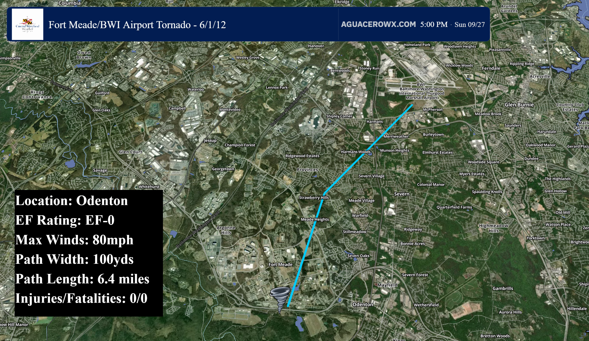
11) Odenton-BWI Airport
The last tornado to affect central Maryland occured in Anne Arundel county, with a 6.4 mile long path beginning in Odenton, and ending on the BWI airport south property. The tornado was an EF0 with winds around 80mph, and a path width of 100 yards
NWS SURVEY:
Damage encountered along the circulation path was primarily trees, consisting of uprooted and snapped trees and limbs.
Minor damage was noted to eaves and siding at an apartment complex along Disney Road, where tree damage was also found. Damage to trees was encountered along Carriage drive, Golden Pine Circle and Gesna Road, and to trees and house siding along Fairbanks Drive. A sun room on one house in this area suffered uplift of a portion of its roof, but uplift appears to be the result in large part of channeled wind.
A decaying tornado was observed by tower personnel and airport patrons crossing the western portion of a runway.