June 5th 2024: Maryland most prolific tornado outbreak on record
On this day in 2024, a severe weather event most Marylanders won't forget struck without much warning as over a dozen tornadoes touched down across the state during the afternoon and evening hours, on a day where the overall risk of severe weather was relatively low, and no tornado watch was in effect. This was the most prolific non tropical storm related tornado outbreak in state history, surpassed only by June 1st 2012, which spawned 13 tornadoes in the region back on June 1st 2012. This string of tornadoes downed hundreds of trees, powerlines, and resulted in significant structural damage including collapsed houses. While we are lucky that there were no fatalities, there were unfortunately 5 injuries as a result of the tornadoes.
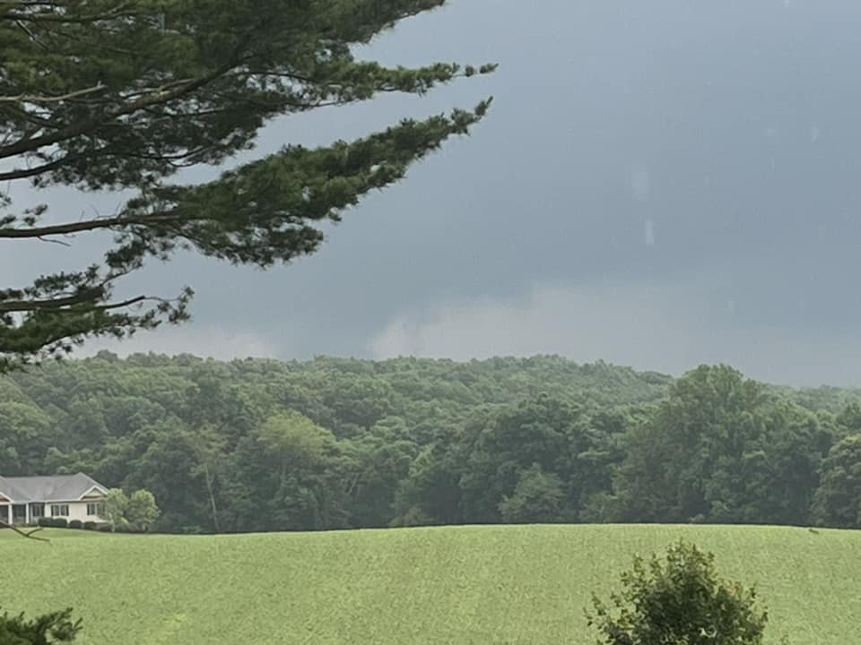
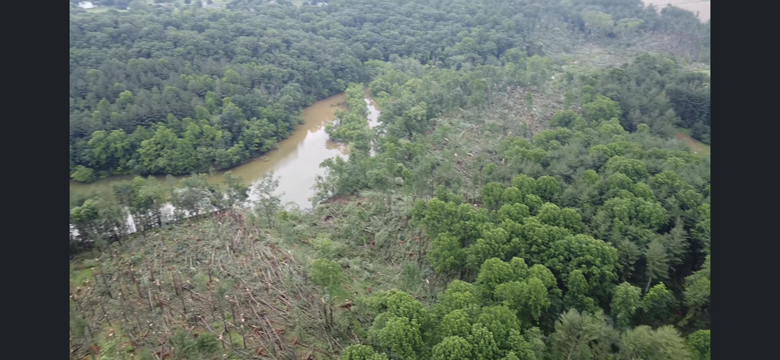
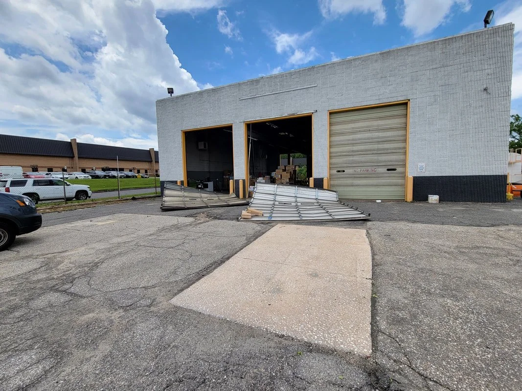

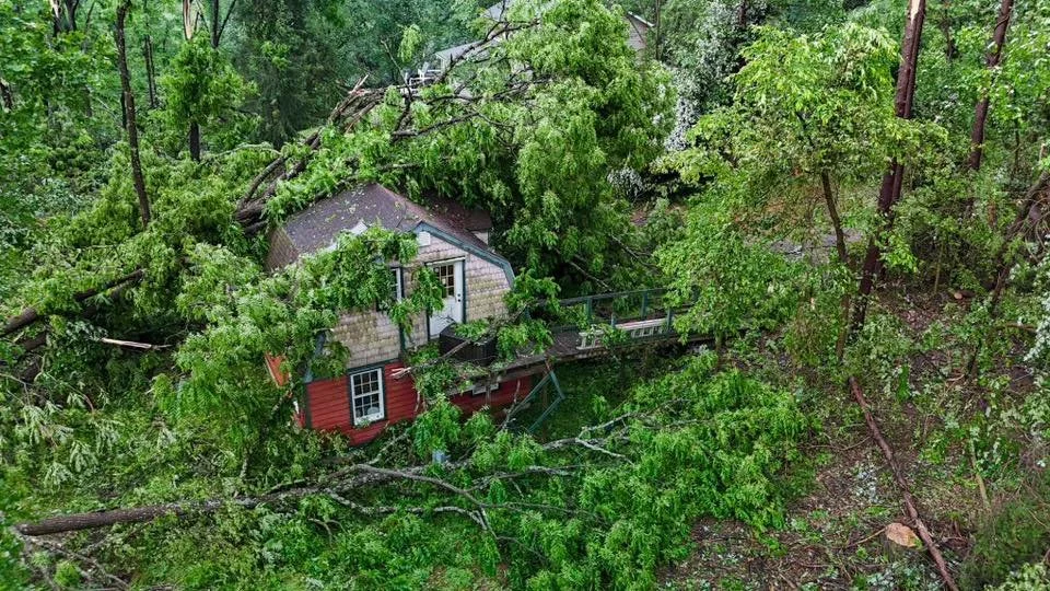
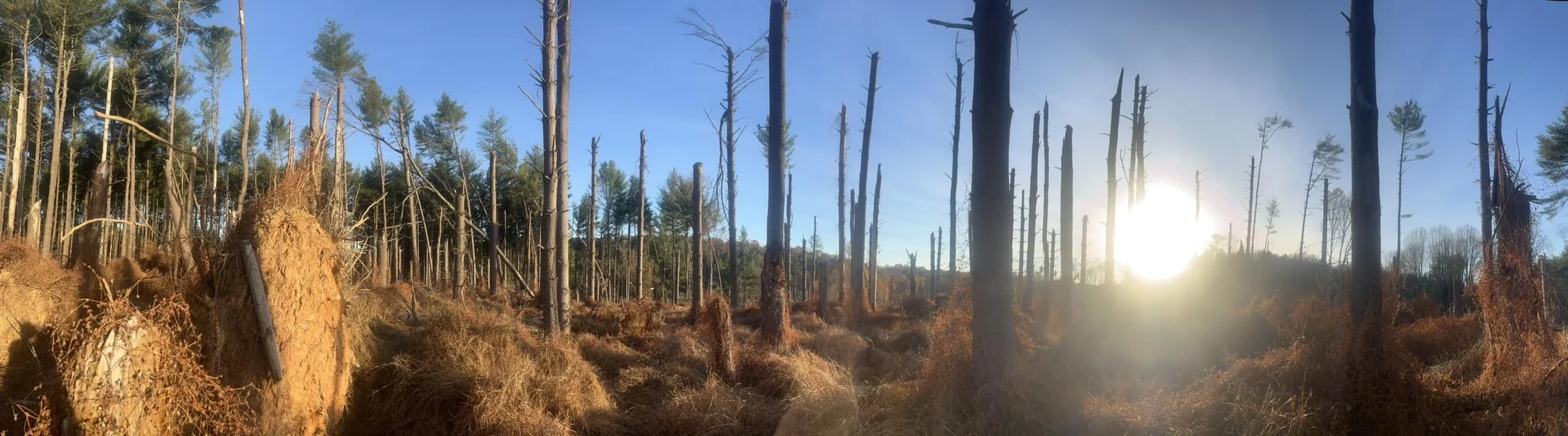
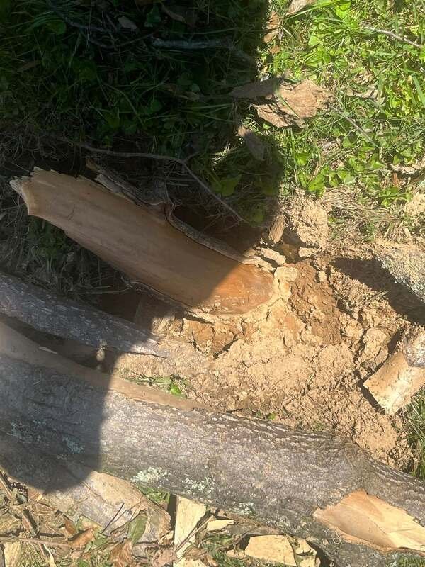
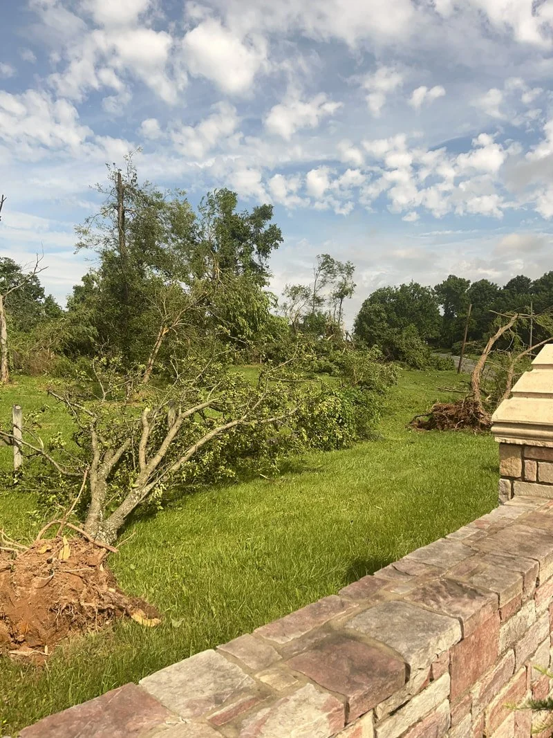
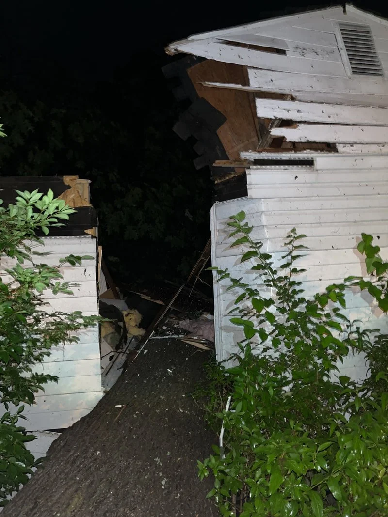
I will go into detail about each tornado below. But first, I would like to give a special thanks to the NWS for their timely warnings, our dedicated trained spotters for sending in reports of tornadoes on the ground, and our first responders who went out in the aftermath to help clean up and take care of the few injuries that occured.
1) Westfriendship/Wynfield:
The first tornado of the day touched down in a small community called Wynfield near Westfriendhsip in northern Howard county. This tornado was never officially confirmed by the NWS, but the damage and radar signatures were consistent with a weak spin up tornado. A well defined hook echo and strong low level velocity couplet was present with this storm. Damage immediately under this signature consisted of uprooted trees, downed power-lines, and large branches snapped off trees. Some of the branches and trees were blown in different directions, including W, SW and E. Given this, and the environment in play, its highly probable that this damage was the result of a brief weak tornado.
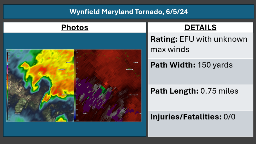
The above information is based on my scientific opinion, using a combination of radar data, a ground survey, and interviews with eyewitnesses. This is NOT official information from the NWS.
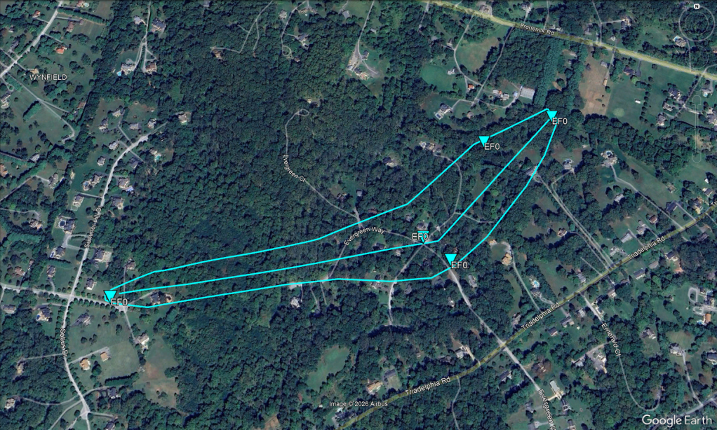
Below is a track that I plotted based on the sporadic damage reports that were collocated with the rotational signature on radar. This is NOT an official survey from the NWS. I first noted damage at the intersection of Sobus Drive and Winfield Road where a few mid sized branches were snapped facing east. Next, a large branch was snapped off a tree and was blown to the southwest on Evergreen Way. At the intersection of Evergreen Way and Ordway Drive, a large tree was uprooted which brought down power lines along with it, blocking the road. Several medium sized branches were also snapped off trees at a private residence on Ordway Drive further to the northeast as the tornado continued moving to the NE. At the far end of Ordway Drive, several trees were uprooted behind a private driveway before the tornado lifted.
2) Boonsboro:
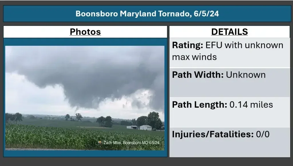
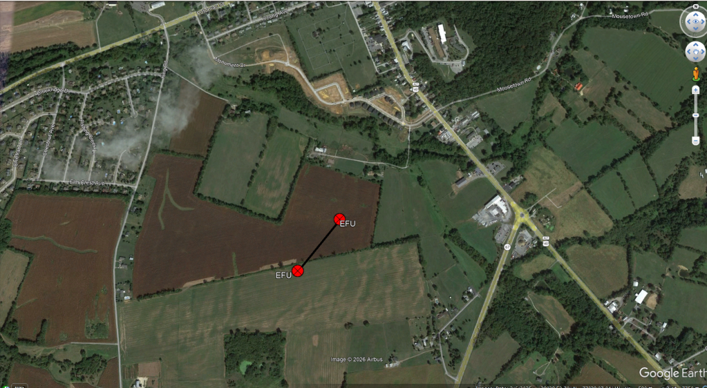
The second tornado of the day touched down in a field in Boonsboro, a small town in central Washington County. This tornado did not result in any damage, as it remained over open fields with nothing in its path. For this reason, the tornado was rated EF-U, since no damage was observed. However, a storm spotter was able to capture the tornado on video, which aided in its eventual confirmation. It is estimated that the tornado was on the ground for 0.14 miles, but the path width and wind speeds cannot be determined.
Tornado Track:
3) Poolesville:
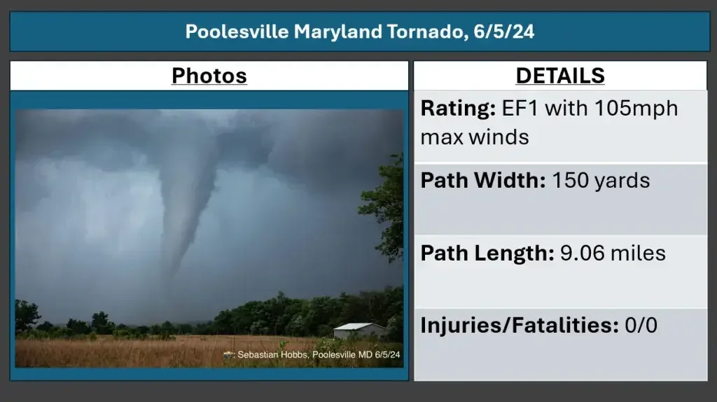
The Poolesville tornado was the first "big" tornado of the day, caught on camera by numerous residents. This tornado was rated high end EF-1 with 105mph winds. It was on the ground for a little over 9 miles, and had a path width of 150 yards.
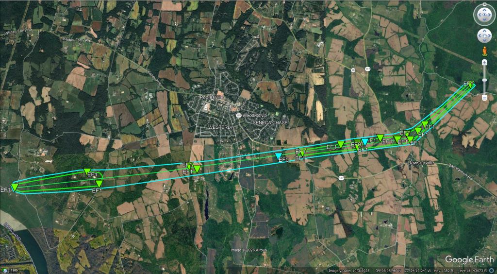
Damage was first noted near the intersection of River Road and Elmer School Road, where several trees were snapped and uprooted. The tornado tracked east over mostly rural areas of western Montgomery county, uprooting additional trees on Edwards Ferry Road. At this point, the tornado began to enter the southern portion of Poolesville, where trees and branches were downed on W Willard Road near the Poolesville Public Golf Course. On the golf course, additional tree damage occured, as well as a large 9,000 pound sea container being partially lofted and bounced multiple times. The tornado continued tracking east, where numerous large trees were snapped and uprooted at Tudor Farm, as well as on Darnestown Road. Here, one of the trees was also debarked, which is a sign of particularly intense winds. Shortly after, the tornado made a hard left turn as the circulation occluded. The final point of damage with this tornado was noted at Seneca Creek State Park, where several trees were downed.
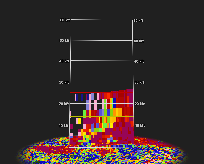
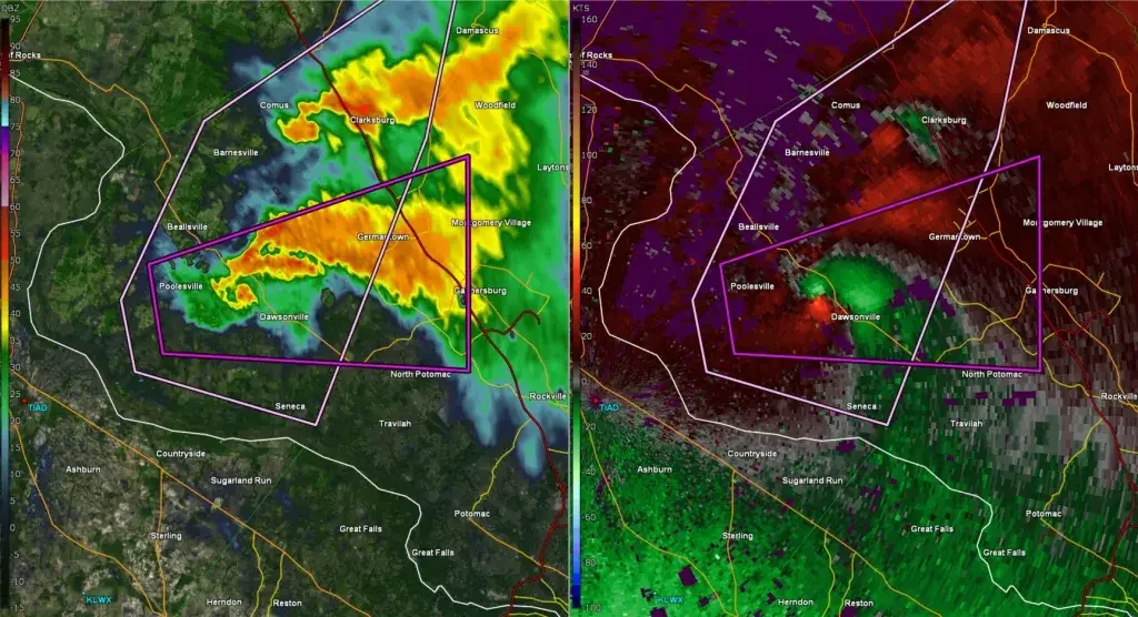
The radar signatures associated with this particular tornado were nothing short of extraordinary. These signatures are something you typically see with tornadoes in the Midwest, not Maryland. This particular supercell developed a well defined hook echo, with a debris ball attached where the tornado was ongoing. In fact, radar data shows that debris was lofted more than 20,000 feet into the air. This is by far one of the most impressive radar signatures I have ever seen for a Maryland tornado, second only to the devastating College Park EF4. This signature, in combination with spotter reports of a tornado ongoing, prompted the NWS in Sterling Virginia to issue its first ever PDS (particularly dangerous situation) tornado warning ever. This is exceptionally rare and reserved for tornadoes that pose an extreme and immediate threat to life and property.
Tornado Track:
4) Gaithersburg:
The next tornado was spawned from the same supercell that produced the tornado in Poolesville. This tornado touched down just south of Germantown, tracked through downtown Gaithersburg, and tracked all the way east almost into Howard County. This tornado was also rated EF-1, with 95mph winds, a path width of 150 yards, and a length of 15.23 miles. Sadly, there were 5 injuries as a result of this tornado.
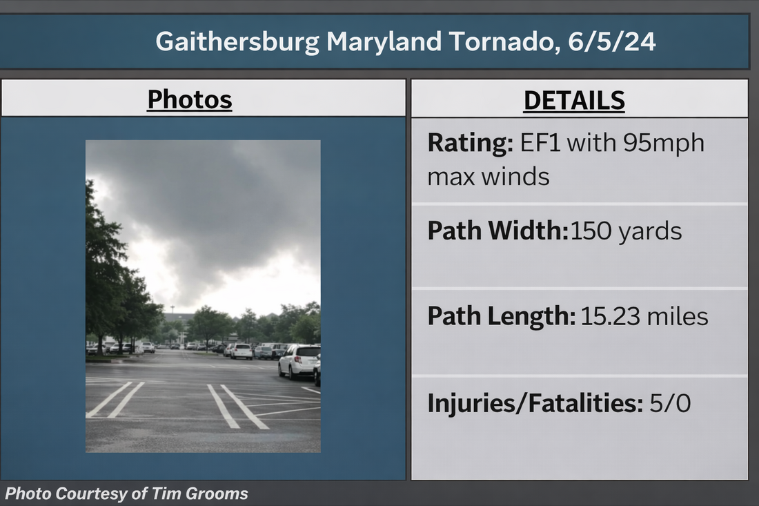
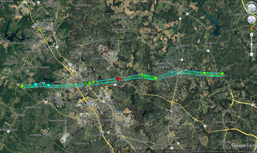
Damage with this tornado was first noted on Indian Grass Drive, where a large tree was snapped, and a video of the tornado was sent in to the NWS. Minor tree damage was then observed on Great Seneca Highway, where some smaller branches were snapped. The tornado then moved into downtown Gaithersburg where it downed trees, some onto houses, in neighborhoods along George Street, Tulip Drive, and Rolling Road. Unfortunately, 7 houses were condemned due to the tornado damage as a result of falling trees. Video of the tornado was taken in the vicinity of Mill Creek Town Park, just east of downtown Gaithersburg. Trees were then snapped and uprooted behind Redland Middle School, where drone video continued to show the tornado on the ground. In Olney, the tornado continued to snap trees and branches, with additional video confirming that the tornado was still on the ground. The Sandy Springs fire department then reported that the tornado did additional tree damage in and around Sandy Springs, before the tornado lifted after downing more trees in Ashton.
Tornado Track:
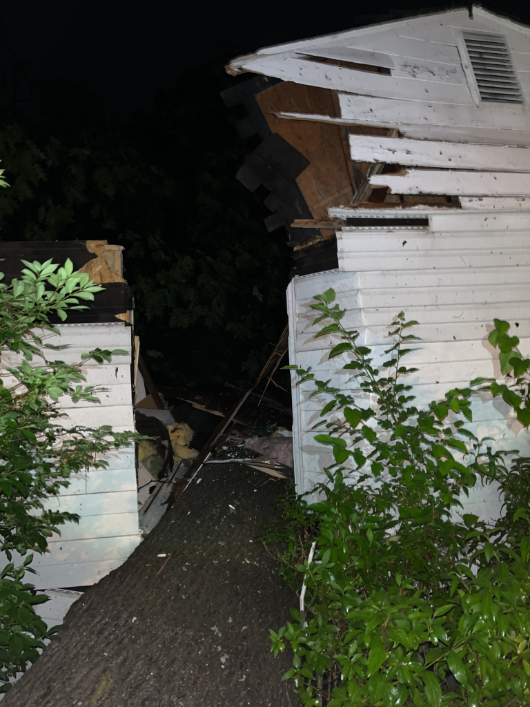
Damage photos courtesy of NWS Balt/Wash
5) Westminster:
Another tornado touched down, and again caught on camera, in Westminster near the Carroll County Regional Airport. This tornado was rated EF0 with 80mph winds. It was on the ground for about 0.4 miles, with a maximum width of around 125-150 yards. There were no injuries as a result of this tornado thankfully.
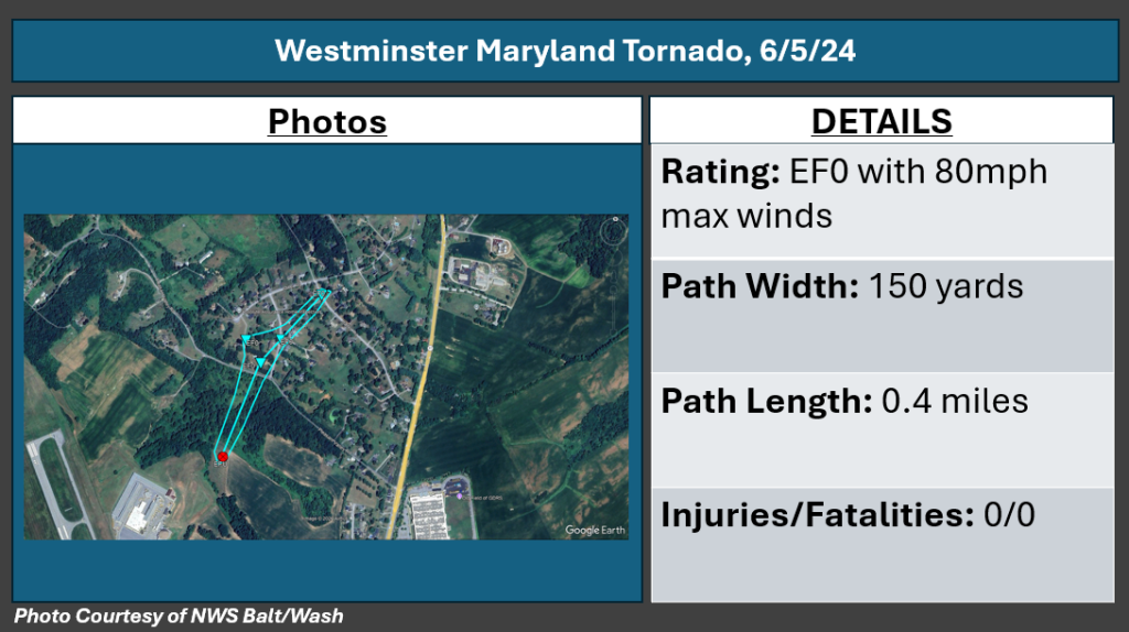
The tornado first touched down in a field just north of the Carroll County Regional Airport. Video shows this tornado lofting tree debris into the air as it moved into the Bear Branch community just northeast of the airport. The first point of observed damage was at the intersection of Pleasant Valley Road and Chris lane where a tree and some large branches were downed. Along Chris Lane, many large branches were snapped off trees, some of which landed onto houses. The tornado continued for a short time to the northeast, snapping additional tree limbs near the intersection of Kalten Road and Miller Road, where leaf splattering was noted on the roadway. The tornado lifted shortly thereafter.
6) Eldersburg:
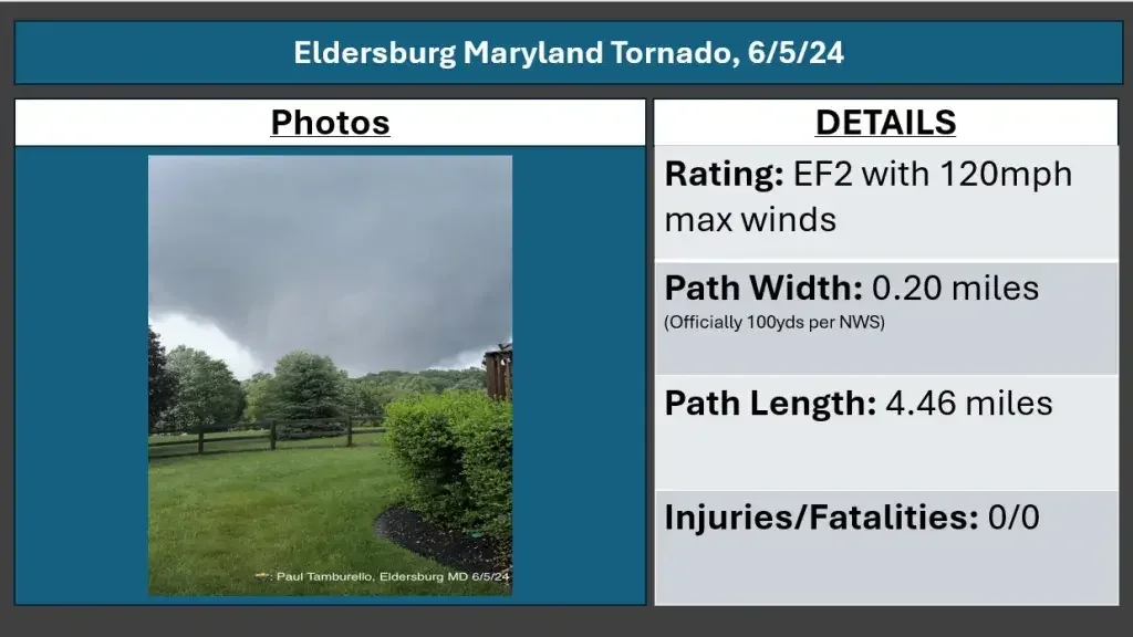
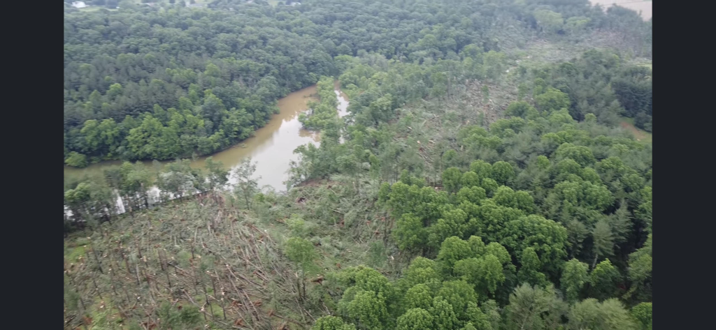
The Eldersburg tornado was the strongest one of the day, coming in as an EF2 with 120mph winds. The tornado was on the ground for a little under 4 and a half miles, and had a path width of nearly a quarter mile based on satellite imagery (official NWS statement is 100 yards). This tornado was caught on camera by several people, as it shredded trees along the western shore of Liberty Reservoir. This is the strongest Maryland tornado since an EF2 tornado struck Annapolis in September of 2021.
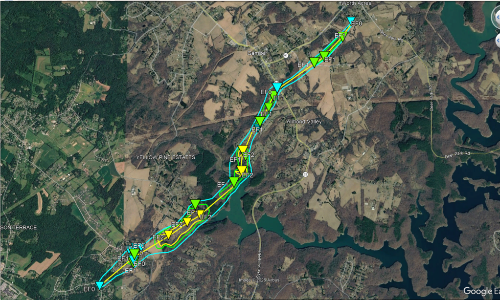
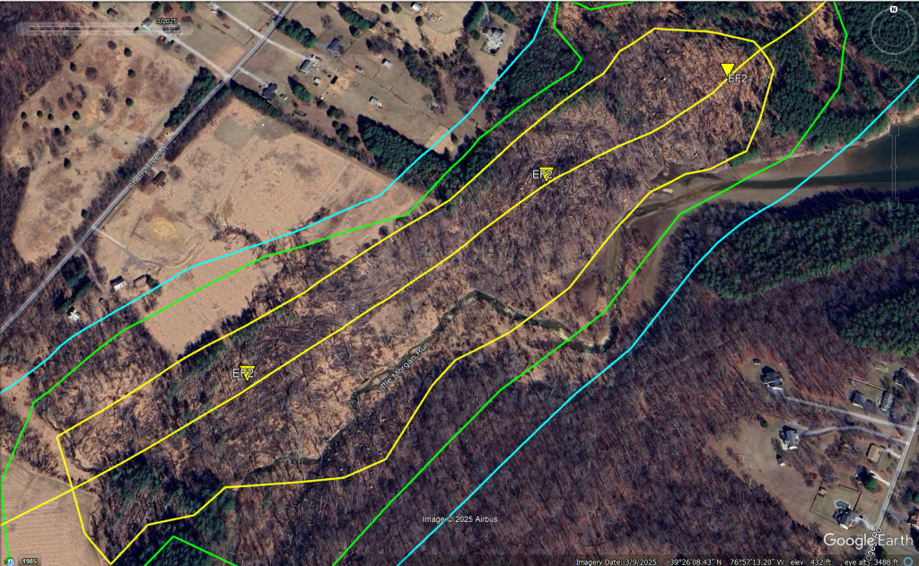
Damage with this tornado was first observed on Tanglewood Drive were 2 trees were downed in opposing directions. The tornado quickly moved into the area of Sarah Drive and Bartholow Road where dozens of trees were snapped and uprooted. In addition to the severe tree damage on Sarah Drive, several homes were damaged by the tornadoes winds, with fascia and shingle damage being reported. The tornado rapidly intensified to EF-2 intensity as it passed behind homes on Cherry Tree lane. Here, it reached its maximum width at nearly 1/4 mile wide. It snapped hundreds of trees, debarking some, along the western shore of Liberty Reservoir. The tornado continued through this heavily forested area with swaths of EF2 level damage until it reached Lake Ridge Drive, where dozens of large trees were uprooted.
Further northeast, the tornado resulted in roof damage to a house on Sun Berry Court, as well as downed numerous trees behind this home in a swath that extended all the way to the Faith Family Church. Next to the church, a house suffered minor shingle and fascia loss, and additional large trees were uprooted on the property. Ground scouring was noted near the church, and large tree limbs were impaled into the ground. The tornado continued its northeasterly trajectory, ripping half the roof off a house and snapping numerous large trees on Gamber Road. A shed was also destroyed nearby to this home. The final noted damage was on Pin Oak Road, where more trees were downed.
Tornado Track:
Top: Damage photo courtesy of NWS Balt/Wash, Bottom: Google Earth Imagery
7) Annapolis Rock:
Another tornado briefly touched down in southwestern Howard county near Annapolis Rock. This tornado was not officially confirmed by the NWS, but the pattern of the damage, which lines up well with radar indicated rotation, indicates that a tornado did occur. Based on the damage photos, winds can be estimated to be around 90mph, which equates to a low end EF1 tornado. It had a max width of about 75 yards, and was on the ground for about a half mile.
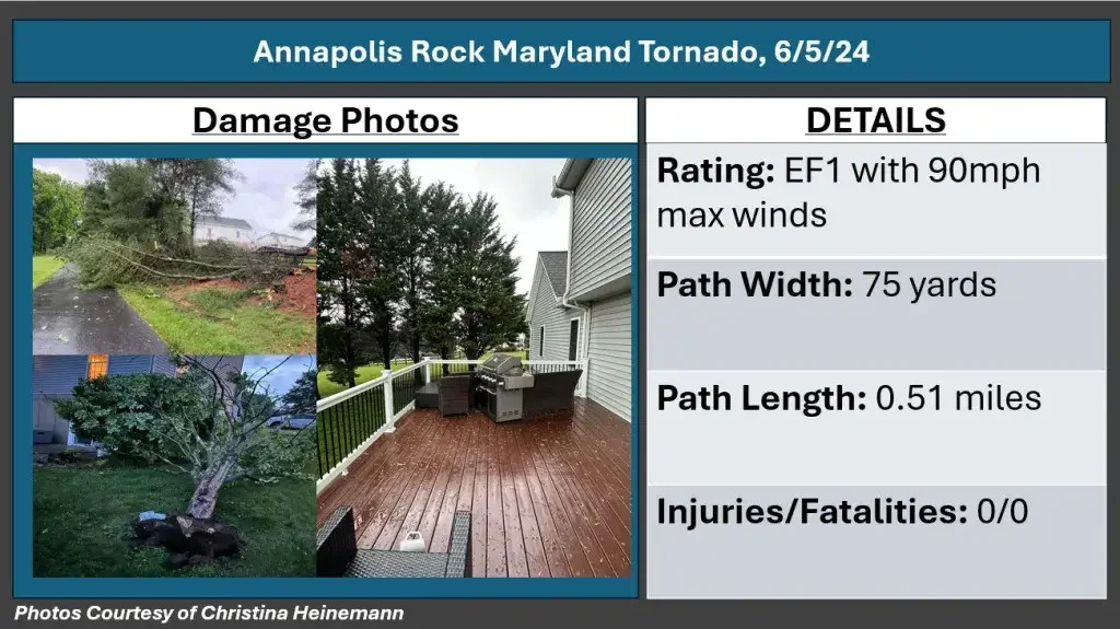
The tornado touched down at the end of Hayloft Court, where it snapped and uprooted at least 4 trees in multiple different directions. Additionally, at least one home suffered loss of shingles, and large lawn furniture, including an approximately 60lb grill, was blown from one side of a deck to another, at a 90 degree angle of the trees. The tornado continued to track up Hayloft Court, where it snapped additional trees in multiple different directions on Starting Gate Court. The tornado then lifted, with no additional damage noted.
Tornado Track:
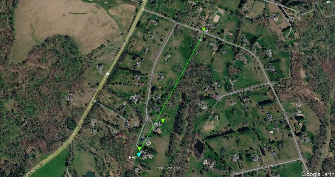
The above information or this tornado is based on my scientific opinion, using a combination of radar data, a ground survey, and interviews with eyewitnesses. This is NOT official information from the NWS.
8) Simpsonville:
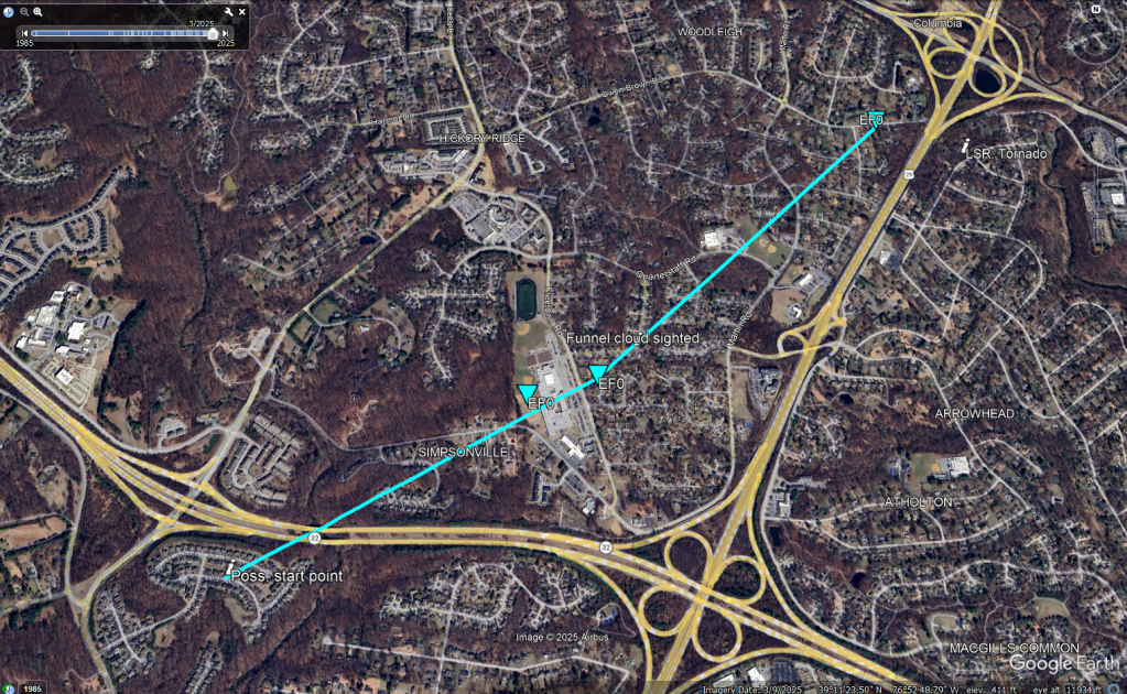
After the Gaithersburg-Ashton tornado lifted, it is likely that an additional tornado touched down near Fulton/Simpsonville. A storm chaser in the area recorded a video of a rapidly rotating funnel cloud very low to the ground, and reported that trees and large branches were blown down. This coincided with a very strong velocity couplet, as well as a report from NWS that a tornado was on the ground. However, no official survey was conducted for this area, so I do not have many details to share. Based on the radar presentation and video, it's likely that this was another brief weak tornado.
Damage was minor and sporadic. The first evidence of damage occured at Atholton High School, where a large section of sports netting was blown down. Immediately across from the school, small sized tree branches were snapped, and some evidence of leaf splattering was noted. It was also in this vicinity where a storm chaser recorded a video of a rapidly rotating funnel cloud very near to the ground. The last point of damage was noted near the intersection of Owen Brown Road and Dewey Drive, where multiple medium sized tree limbs were snapped off. A rotating funnel cloud was sighted shortly after near Hopewell Park, prior to the touchdown of the Columbia tornado, which adds confidence that the damage in Simpsonville was in fact a tornado.
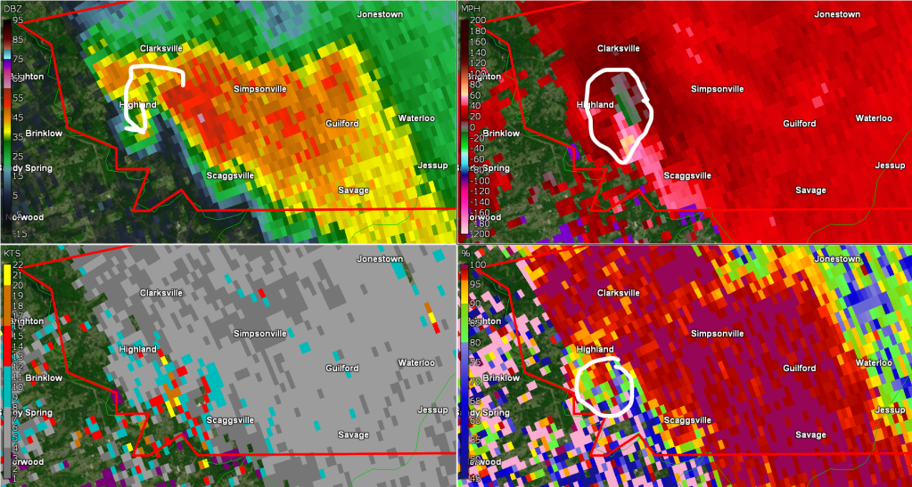
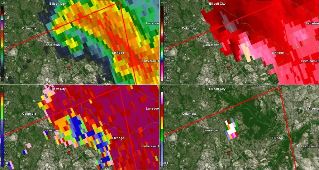
Below is a radar scan of when the tornado occured. In the top left, a well defined hook echo is present, followed by strong rotation in the top right, and a possible TDS (tornado debris signature) in the bottom right. All signs that a tornado was ongoing when combined with video and damage reports. It was also at this time that NWS reported a tornado on the ground in this location, and upgraded the tornado warning from radar indicated, to confirmed tornado.
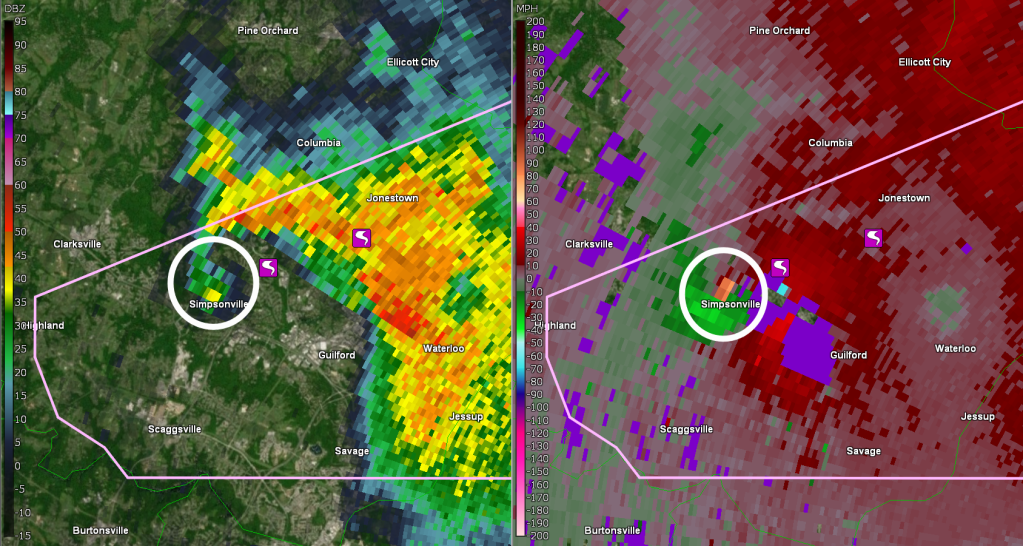
Taking a look at the lower level of the atmosphere using the radar out of BWI Airport, a clear tornado signature was evident directly correlating with where the damage was observed. Meteorologically speaking, a NROT of >2, VROT of 35kts, a very strong and persistent velocity couplet, and a well defined hook echo (note a potential debris ball with enhanced reflectivity at the base of the hook echo) all indicate that the damage done was very likely to be a tornado.
Below is a track that I plotted based on the sporadic damage reports that were collocated with the funnel cloud video and rotational signature on radar. These damage points and associated track directly correlate with the strongest area of rotation on radar.
NOTE: This is NOT an official survey from the NWS.
9) Columbia:
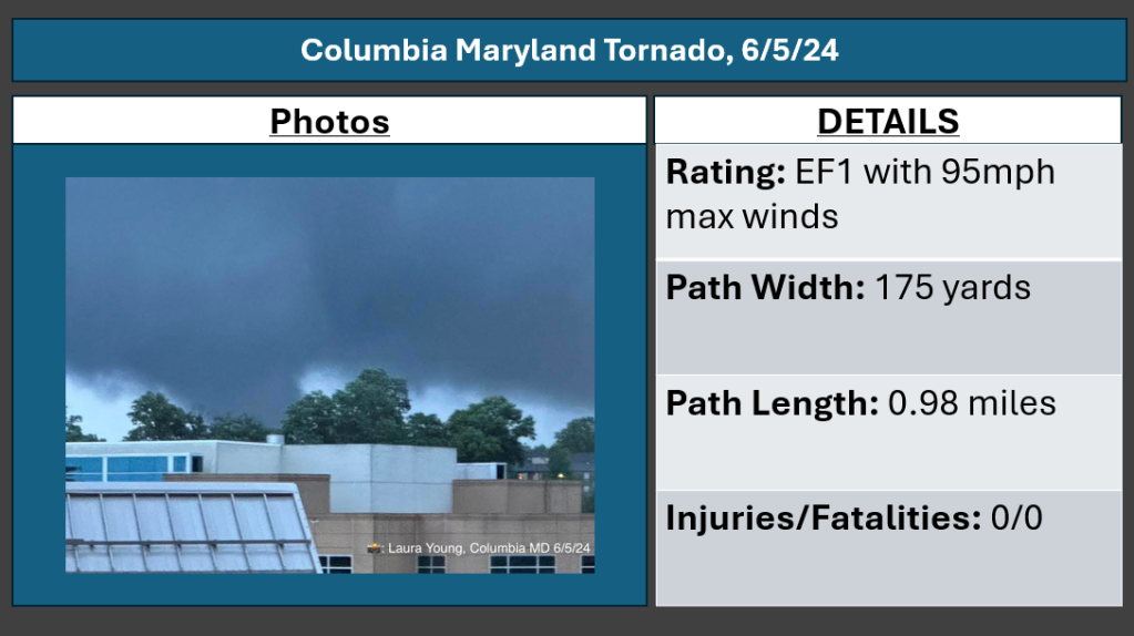
The next town to be hit by a tornado was Columbia in Howard County, specifically the Long Reach Community. This tornado was spawned from the same supercell that produced the 2 tornadoes in Montgomery county. This was an EF1 tornado with 95mph winds, a path length of just under 1 mile, and a maximum width of 175 yards.
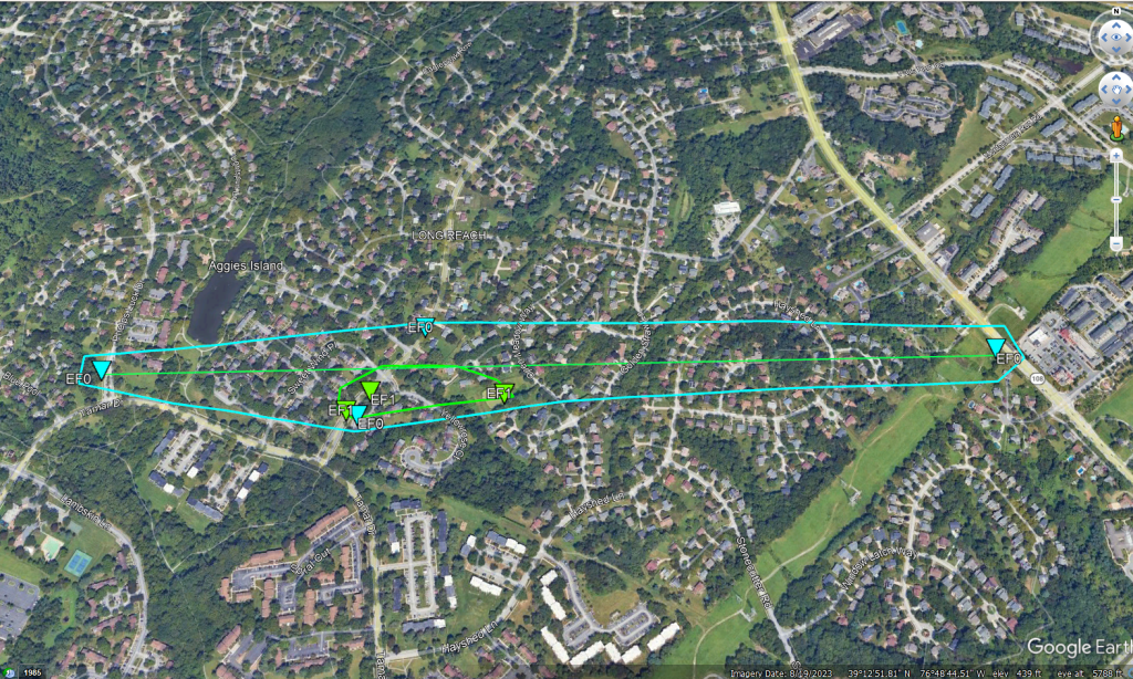
The tornado touched down at the intersection of Tamar Drive and Phelps Luck Drive, where large tree branches were snapped. The tornado then impacted High Tor Hill, where around a dozen large pine trees were snapped near the base, and topped off. Houses also suffered minor damage to their shingles, siding, and gutters on Yellow Rose Court. In this same neighborhood, several cars were totalled due to the tornado damage. The next area of damage was observed behind Open Meadow Lane, where several trees were snapped at a retention pond. The tornado finally lifted between Hayshed Lane and Maryland Route 108 after resulting in additional minor tree damage at the 5600 block of Waterloo Road, about a half mile north of the Maryland School For The Deaf (which is next to where I used to live. A little close for comfort!...). Videos of the tornado taken from the Long Reach area, Waterloo, and Hopewell all showed the tornado on the ground
Tornado Track:
The radar presentation for this tornado was very impressive for a mid atlantic tornado. A well defined hook echo and even a detached debris ball. This is not something you see very often, let alone in Maryland. Additionally, a very deep tornado debris signature was evident, with debris lofted to more than 5,000 feet into the air!
10/11)Arbutus/Halethorpe Double Tornadoes:
The same supercell that produced the two tornadoes in Montgomery county, and the tornado that struck Columbia, also produced two EF1 tornadoes in the Arbutus/Halethorpe areas of Baltimore County, tracking into the southwest corner of Baltimore City. The first tornado was on the ground for just under a mile, and the second for approximately 1.3 miles. The first tornado had maximum winds of 95mph, and max winds of 105mph for the second tornado.
NOTE: There was large gap in the damage, indicating the tornado lifted and touched back down. While the official NWS survey states this was a single tornado, this was in fact 2 separate tornadoes. I have separated the track to represent both tornades with their respected individual stats (rating, path length, path width).
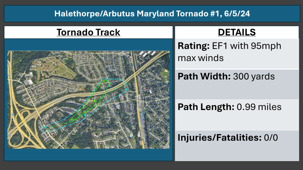
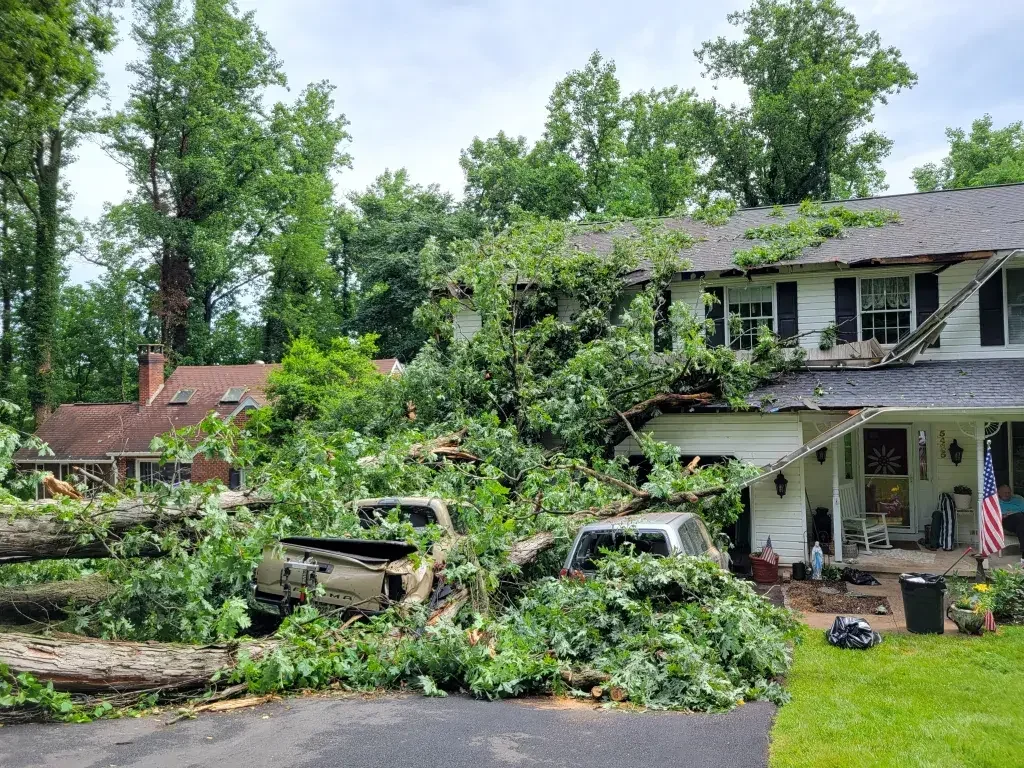
The first tornado touched down on Selford Road, and snapped/uprooted trees in many areas from Selford Road, northeast to Ingate Road. This included trees and power lines down on Friendship Road. A large oak tree fell onto a house as well as a few cars at this location. Multiple videos were taken from the area of I-95 and 195 of the tornado on the ground moving through this neighborhood. Additional trees were also downed on Francis Avenue and Mineral Avenue as the tornado passed through. As the tornado moved northeast, it resulted in additional snapped and uprooted trees, as well as downed power lines on Elm Road and Carville Avenue, before cycling and lifting briefly.
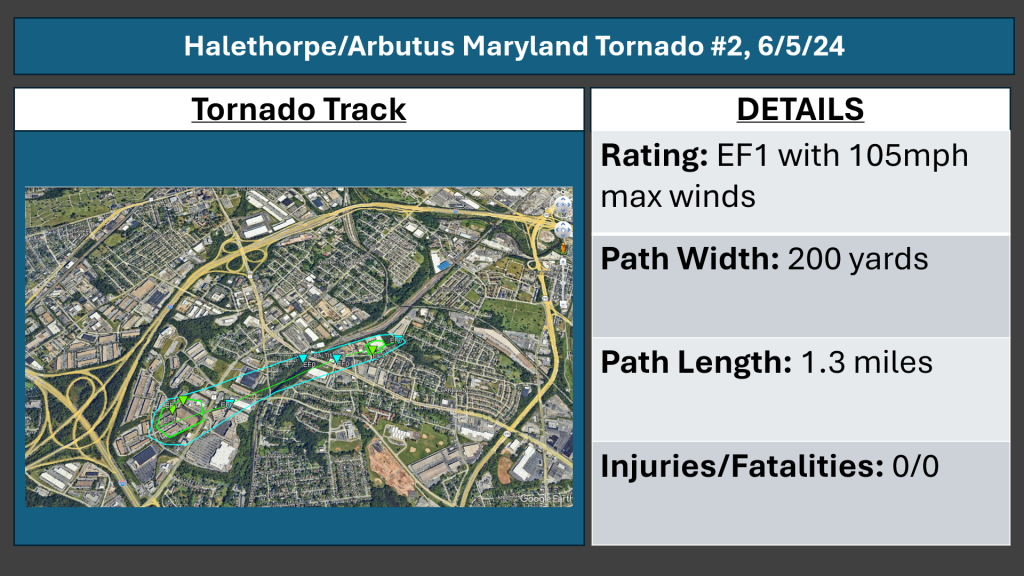
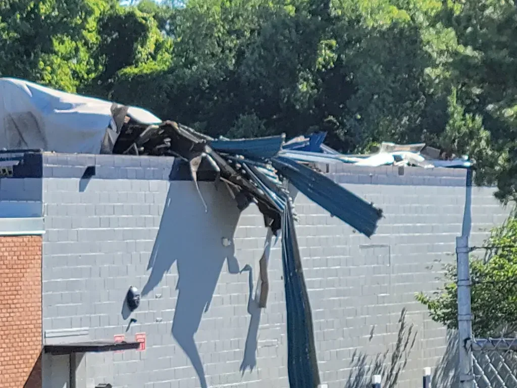
Further northeast the second tornado tornado resulted in moderate structural damage to several buildings on Robert A Young Way, where large, heavy metal doors were blown in at the Amazon HQ facility. Additionally, pieces of an awning as well as roofing material were blown off an adjacent warehouse type building. On the other side of Route 1, several trees were snapped and twisted. As the tornado continued on its northeast track, it snapped and twisted additional trees and tree limbs along the B&O Railroad, as well as on Neiman Avenue. The tornado lifted shortly after, but not until it did considerable roof damage to a warehouse on Neiman Avenue, as well as snapping another tree. Several roofs were heavily peeled back and damaged at these warehouses.
Damage photos courtesy of NWS Balt/Wash
12) Baltimore City/Canton:
A waterspout formed over the Baltimore Harbor, and came ashore as an EF0 tornado in the Canton area of Baltimore City. This tornado had maximum winds around 70mph nad was on the ground for less than half a mile, with a maximum width of about 90 yards.
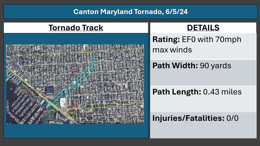
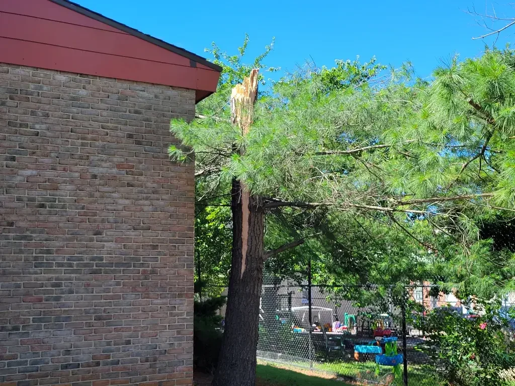
The waterspout came on shore at the Anchorage Promenade Park. The now tornado, moved northeast into the Canton area of Baltimore City. At the intersection of Hudson Street and S Luzerne Avenue, small branches were snapped and street signs were tossed around. A large pine tree was snapped in half, with many branches also broken on Fait Avenue. Additional large branches were snapped, and trash cans were tossed at the Hatton Senior Center. As the tornado continued moving northeast, a tree was uprooted, and an awning was blown off on Foster Avenue, where a stop sign was also heavily bent over. No further damage was noted beyond this point.
Damage photos courtesy of NWS Balt/Wash
13) Middle River:
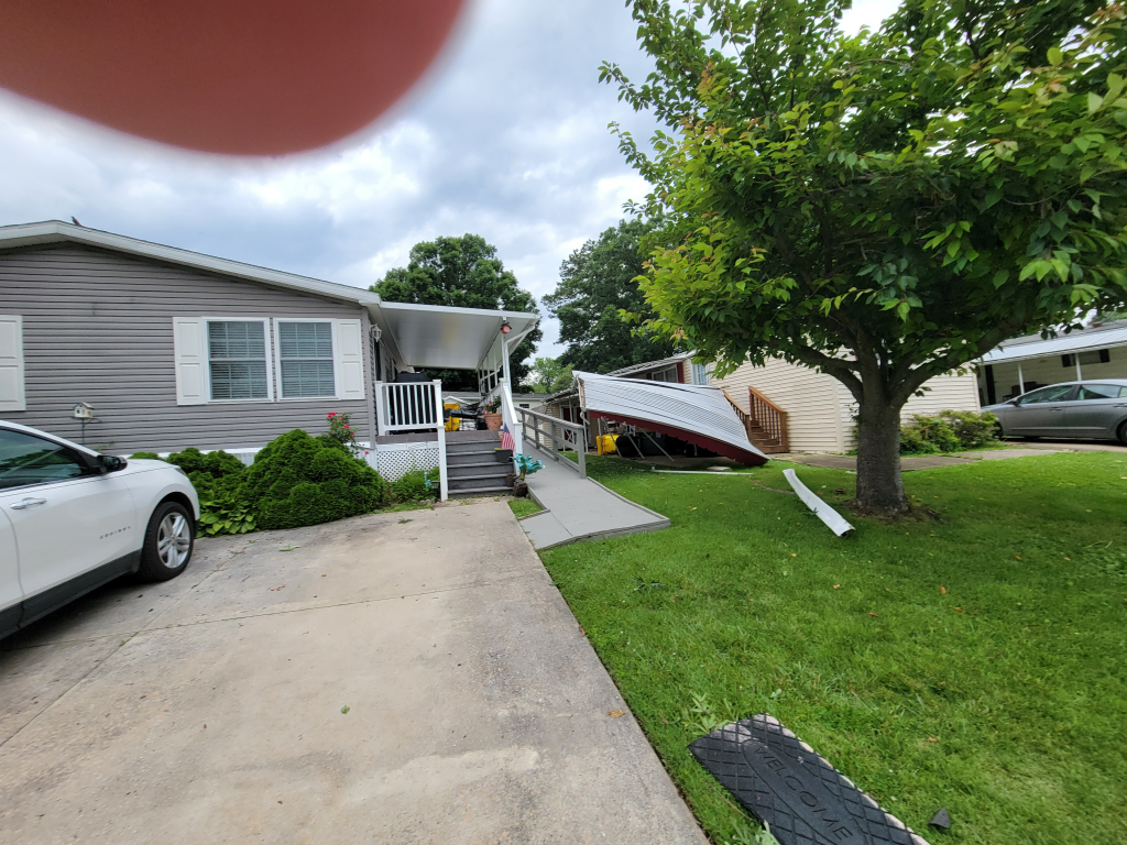
The next tornado touched down for a short period in Middle River in Baltimore County. This tornado was also rated a high end EF1 with maximum winds of 105mph. It was on the ground for just 0.14 miles, and had a path of 110 yards. The tornado damaged trees as well as several mobile homes which suffered significant damage.
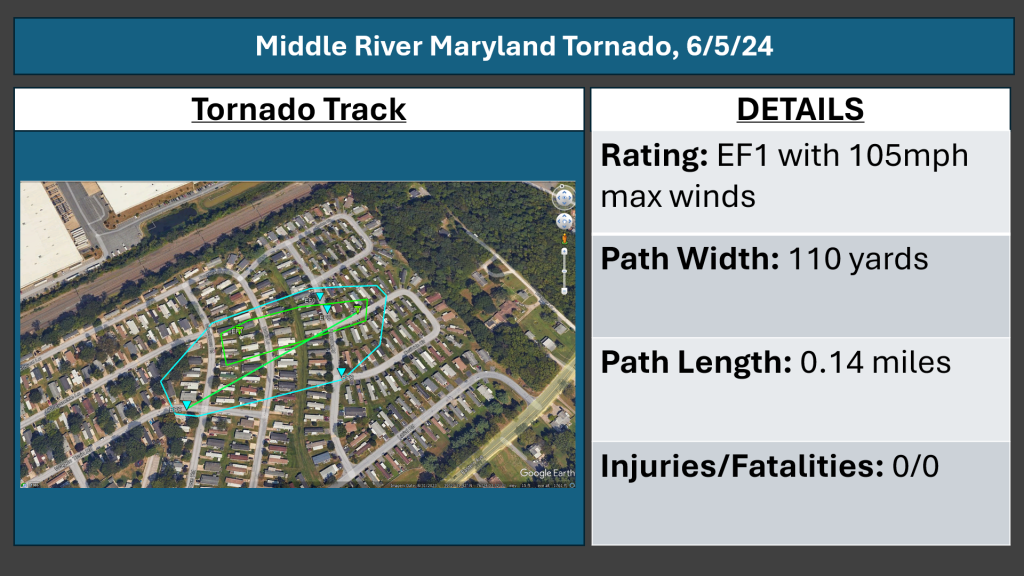
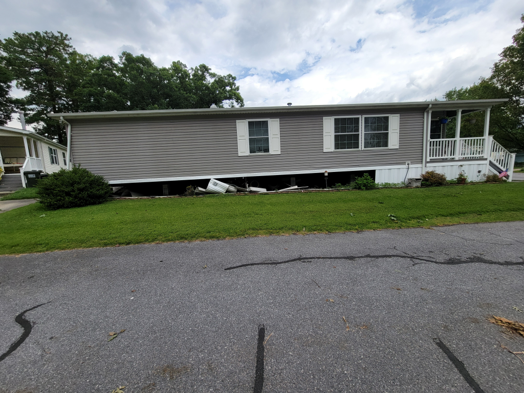
The first evidence of tornadic damage occured on Wagon Train Road where underpinning was removed from a mobile home. Additionally, an awning was torn off and thrown into a neighboring yard. The tornado then moved between Wheelhouse Road and Dahlia Lane, where several mobile homes had the underpinning removed. Two large sheds in this area were lofted and thrown at least 50 yards, as well as being lofted at least 10 feet into the air. Several mobile homes along Roundup Road had damage to underpinning, siding, flashing, and shingles as the tornado moved through. It also snapped several tree limbs on Cowhide Circle, where large trees were also snapped. Finally, a trampoline was lofted and thrown 50 yards from the residence, No further tornado damage was found past this point.
Damage photos courtesy of NWS Balt/Wash
14) Aberdeen Proving Grounds:
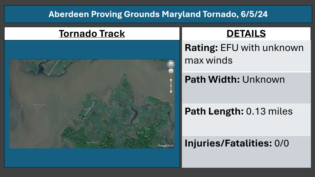
The final tornado occured at the Aberdeen Proving Grounds. A rotational couplet on radar, combined with a well defined debris signature that was present for multiple scans, indicate that a tornado occured. Additionally, a damage scar was left behind and is visible on satellite imagery. No survey was conducted by the NWS, so no rating can be assigned for this tornado. Therefore, it will be labeled as EFU, with an unknown max wind speed. However, satellite imagery suggests the damage scar was between 1/10th and 1/15th of a mile long.
Thank you to my friend Gio for pointing this out to me a few days after while he was reviewing radar data.
Radar Analysis:
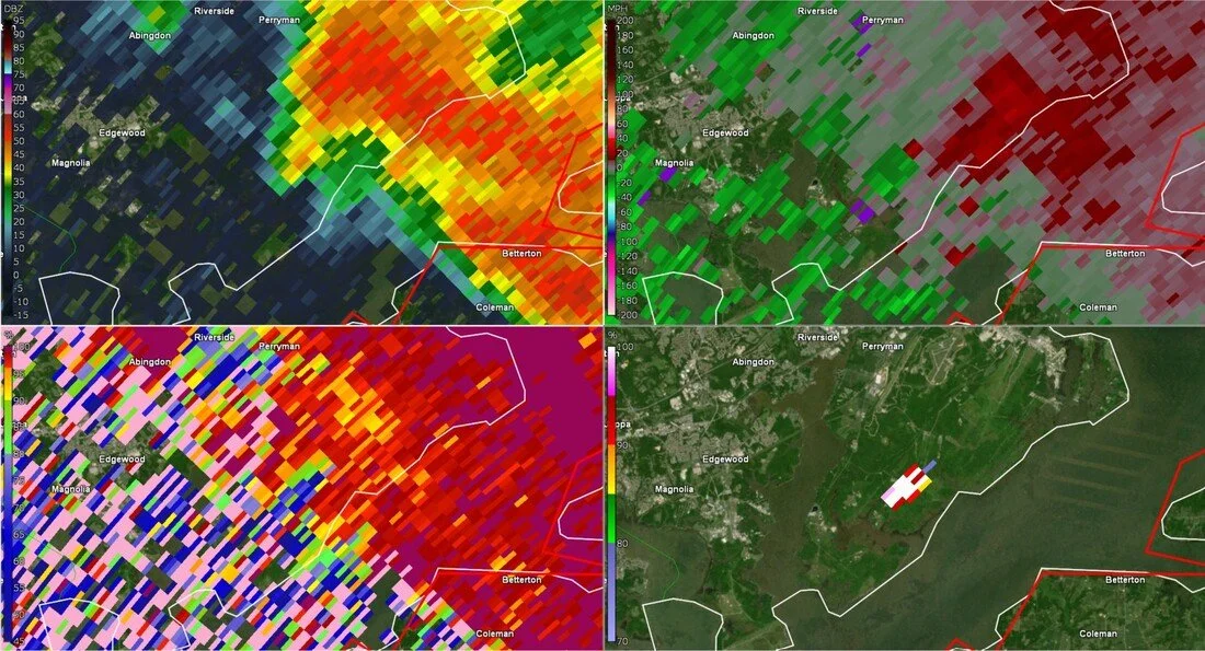
Upon close inspection of radar, all signs indicate a confirmed tornado. A strong velocity couplet (rotation) is collocated with a TDS (tornado debris signature) indicated by a lowered CC value. This debris was lofted to more than 8k feet based off of the radar out of Dover Delaware. This all occured in the same location of the damage scar mentioned earlier, which means this was indeed a tornado.
Final Notes:
In total, 14 tornadoes touched down on this day, the most in over a decade (not related to tropical systems). This was an incredibly impactful tornado outbreak for Maryland, and one that will be remembered for a long time. Thankfully, there were no fatalities, although there were sadly 5 injuries as a result of these tornadoes. Please take this as a reminder that tornadoes do occur in Maryland, and can be extremely damaging and even life threatening.
One thing you may notice is that while the majority of the data in this article was sourced from the official surveys conducted by the NWS, I did add some details that were missed and corrected a few minor but important errors in the surveys. I want to once again thank the NWS, local broadcast partners, first responders, and emergency managers for getting our residents through this historic outbreak with no fatalities.
