Damaging Microbursts Strike Frederick and CARROLL cOUNTIES ON jUNE 15TH 2026
On the evening of June 15th, 2026, a band of supercells developed over the Catoctin Mountains in a zone of enhanced low level convergence. This backed the winds to the southeast at the surface, locally enhancing the wind shear near these storms. While the main supercell was rotating, LCLs were high enough to prevent a tornado from occurring. However, areas of rotation in storms with the high instability and high shear environment we had can result in enhanced areas of wind damage, which is exactly what occured. These severe storms tracked into central and eastern Frederick county, as well as Carroll county, where 2 intense microbursts developed.
Libertytown/Unionville
The first microburst occured in eastern Frederick county near the towns of Libertytown and Unionville. The National Weather Service conducted the following storm survey of the damage caused by this microburst:
Public Information Statement National Weather Service Baltimore MD/Washington DC 424 PM EDT Mon Jun 15 2026 ...NWS Damage Survey for 06/14/2026 Thunderstorm Wind Event...
Overview: The National Weather Service survey team determined wind damage associated with a Severe Thunderstorm located near Libertytown, MD was from straight-line winds. Survey Summary: On June 15, 2026, a survey team from the National Weather Service Baltimore/Washington Weather Forecast Office conducted a formal storm assessment in Frederick County, Maryland. The objective of the field survey was to analyze the thunderstorm wind damage that occurred during the evening of Sunday, June 14, 2026.
The event began at approximately 7:30 PM EDT, when a cluster of showers initiated in central Jefferson County, West Virginia. This convective system tracked continuously northeastward into Frederick County, Maryland, while exhibiting steady intensification. As the storm progressed east of Libertytown, Maryland, it generated a localized zone of significant structural and tree damage. The most severe impacts were concentrated within the 9000 block of Bessie Clemson Road. Based on the degree of damage observed, peak wind velocities in this specific corridor were estimated up to 80 MPH. Physical evidence at the scene included numerous snapped and uprooted soft and hardwood trees, alongside the total wall collapse of a barn structure. Analysis of the debris field and fallen vegetation revealed a strictly unidirectional damage pattern. This uniform orientation aligned precisely with the forward motion of the storm, confirming the absence of rotational characteristics.
Therefore, the National Weather Service Baltimore/Washington Weather Forecast Office has classified the destruction as a straight-line wind event driven by downburst winds. Outside of the immediate Bessie Clemson Road impact zone, the thunderstorm produced sporadic wind damage across the broader county. These widespread convective wind gusts were estimated to range from 60 to 80 mph with all associated damage matching the directional trajectory of the storm.
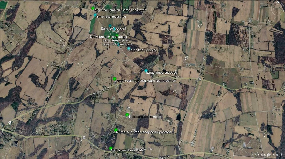
Earlier this afternoon, I was also able to survey the damage, as well as being able to speak with residents in the affected area. I noted numerous large trees and tree limbs snapped along Coppermine Road from Schoolhouse Road to Route 31. Additionally, a barn had its roof removed, and another had its roof buckled. At the northern end of Coppermine road, several large limbs were snapped off of trees, a gazebo was destroyed, and a grill was rolled.
Further south, along Bessie Clemson Road, the damage was very extensive. Numerous trees were both snapped and uprooted just north of Route 26 on Bessie Clemson Road, where a cell tower was also completely bent over. Powerlines were also snapped along this stretch of the road. At the Horses Healing Humans Farm, a large horse arena was completely destroyed, with more than half of the structure being collapsed. Additionally, large trees were uprooted, and a barn roof was blown off near the intersection of Bessie Clemson and Route 31.
My Thoughts: I completely agree with the National Weather Service in their determination that the damage here was caused by a microburst. However, while I fully respect and acknowledge the findings of the NWS, there are 2 damage points that stand out to me that strongly suggest winds were higher than the official rating of 80mph.
The cell tower collapse would typically be rated between 115-133mph based on the lower and expected bound winds in the official NWS Damage Indicator table (more specifically, damage indicator 23, DOD 2; Cell tower collapsed). Additionally, the severity of the horse arena damage is indicative of winds that reached or exceeded 100mph. Specifically Damage Indicator 1, DOD 6, which is collapsed walls of a barn, and has a lower bound/expected bound/upper bound wind speed of 81mph/97mph/119mph. Given the size of the structure, and proximity to the collapsed cell tower, it seems more reasonable that winds at the peak of this microburst were between 100 and 120mph.
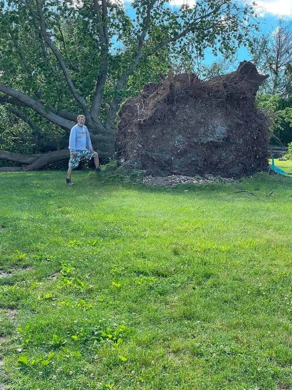
Photo Credit: Horses Healing Humans
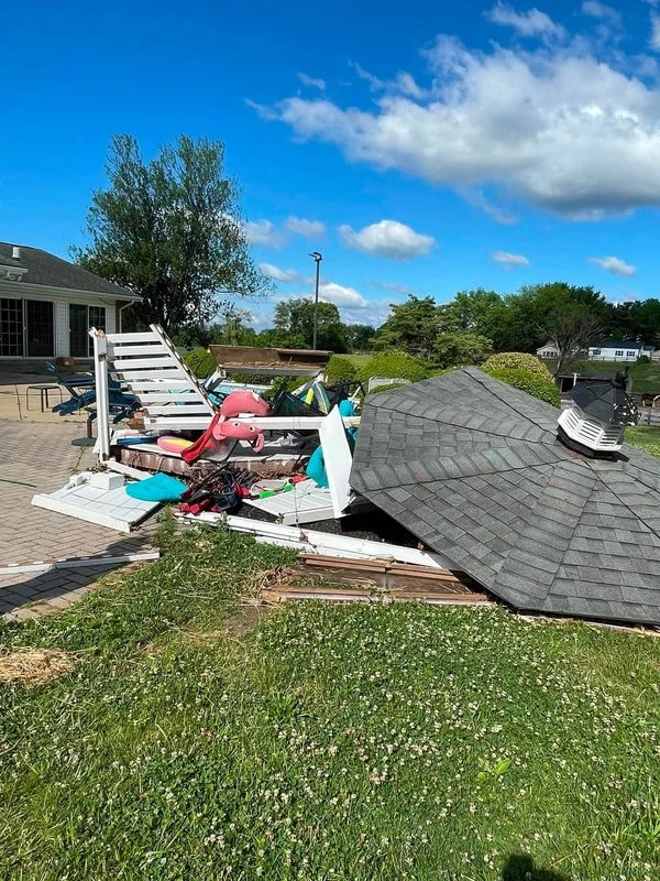
Photo Credit: Horses Healing Humans
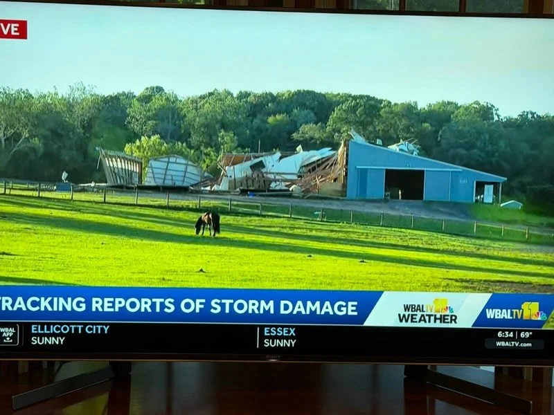
Photo Credit: WBAL TV11 News
Westminster
The same storm that produced the microburst in Frederick county, also produced one in Westminster in Carroll county. No National Weather Service survey was done in Westminster, but I did one this afternoon and found strong evidence of straight line winds in the 60-70mph range.
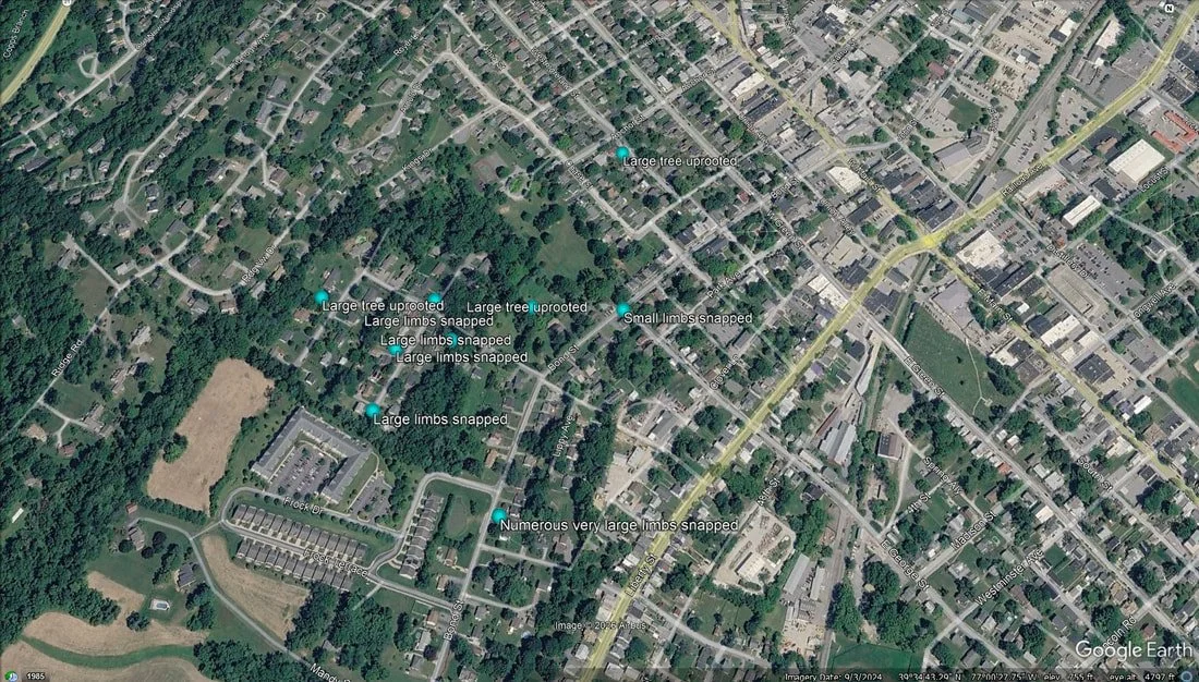
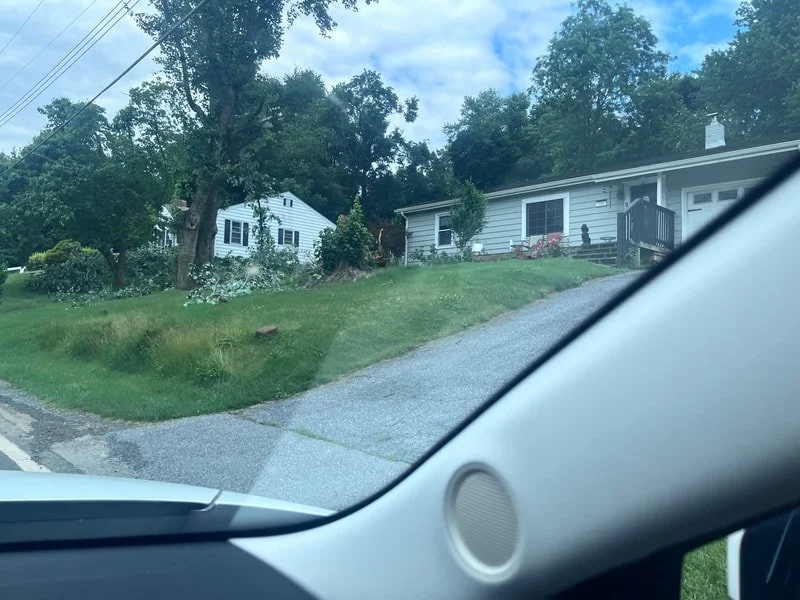
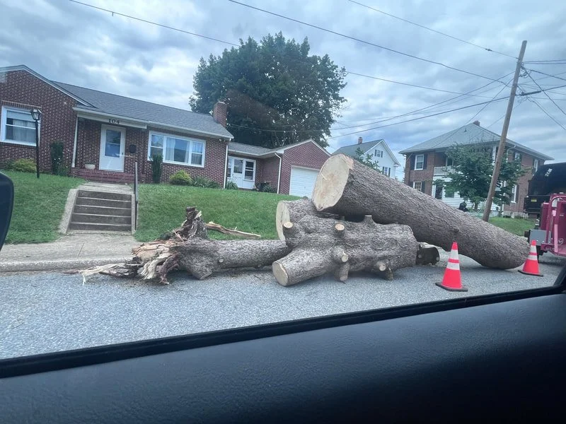
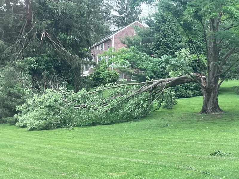
All of the damage I observed was to trees. I did not observe any structural damage outside of one home with a tree on its roof. The most concentrated area of damage was along Park Drive, where several cul-de-sacs saw countless very large tree limbs snapped. There were also a few large trees that had been completely uprooted here. On Bond Street, several very large tree limbs were snapped off trees south of Park Drive, and a tree fell onto a house near Ridge Road. Finally, a large tree was also uprooted on Anchor Drive.
Given the extent of the tree damage, which included the snapping of both softwood and hardwood tree branches, winds can be estimated to have been in the 60-70mph range in this microburst.