July 28th Tornado event
On the evening of July 28th 2026, 5 tornadoes touched down across the state of Maryland, making this the largest tornado outbreak since June 5th 2024. Two of the tornadoes touched down in Talbot county on the eastern shore, but 3 more touched down locally in Anne Arundel County. One was rated EF-0 with the other two rated EF-1. Two of the Anne Arundel county tornadoes were on the ground simultaneously for a few minutes. Additional surveys are ongoing, and more tornadoes may be confirmed in the coming days.
Orchard Beach EF-0
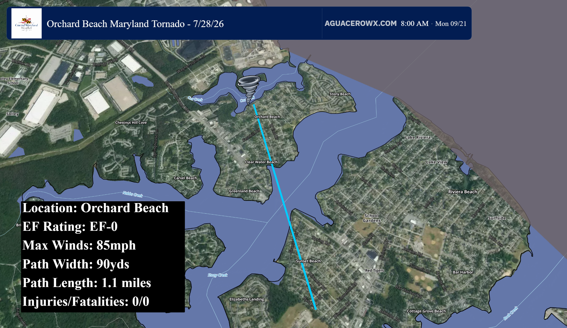
At approximately 6:04pm, a waterspout moved on shore becoming a tornado. The tornado flipped a grill and downed numerous large branches and trees near the intersection of Waterview Dr and Riverside Dr. The tornado moved generally south, bending a street sign and tearing off large sections of siding from a home on Hilltop Rd. Numerous trees were also blown down here. The tornado then crossed West End Drive where large limbs were snapped off the tops of trees near Park Pl. Further down West End Dr, large tree limbs were sheared and twisted off tree tops near Fieldstone Pl.
Then, the tornado emerged as a waterspout over Stoney Creek, before becoming a tornado again as it reached Sunset Park. In Sunset Park, additional trees were blown down, and a power pole was also knocked over before the tornado dissipated at 6:06pm.
This tornado was rated EF-0 with maximum winds of 85mph. The tornado was on the ground for 1.1 miles and was 90 yards wide.
North Shore EF-1
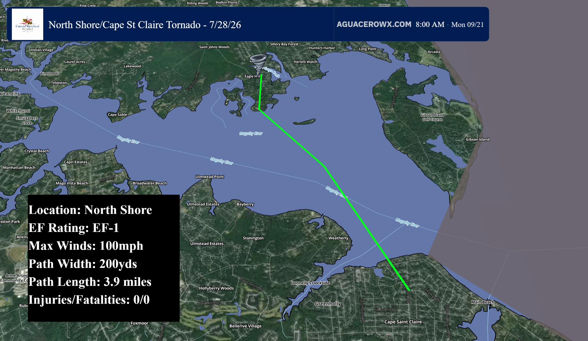
A second tornado touched down in North Shore at around 6:15pm. The tornado touched down on Patapsco Rd where trees were snapped and uprooted. The tornado quickly intensified as it reached Magothy Rd, where numerous trees were snapped and uprooted, power poles were snapped, and a boat was lofted into the air before being thrown over a pier. On Magothy Rd, several houses suffered damage including the removal of shingles and siding.
As the tornado continued south, it crossed Gray's Creek as a waterspout, before emerging as a tornado once again on Dobbins Lane where additional trees were uprooted. Trees were also snapped along Edgewater Rd, where numerous uprooted trees were also found. Prior to dissipating, the tornado was caught on security camera footage just south of Edgewater Rd.
The tornado then crossed the Magothy River as a waterspout, before re emerging as a tornado in Cape St Claire. Here, it snapped and uprooted trees along River Bay Road as well as nearby to Broadview Drive and Saint Catherine Drive. This is also where a resident observed dirt and debris being lofted into the tornado shortly before the tornado dissipated at 6:22pm.
This tornado was rated EF-1 with 100mph maximum winds. The tornado was on the ground for just under 3.9 miles and was 200 yards wide.
Cape St. Claire EF-1
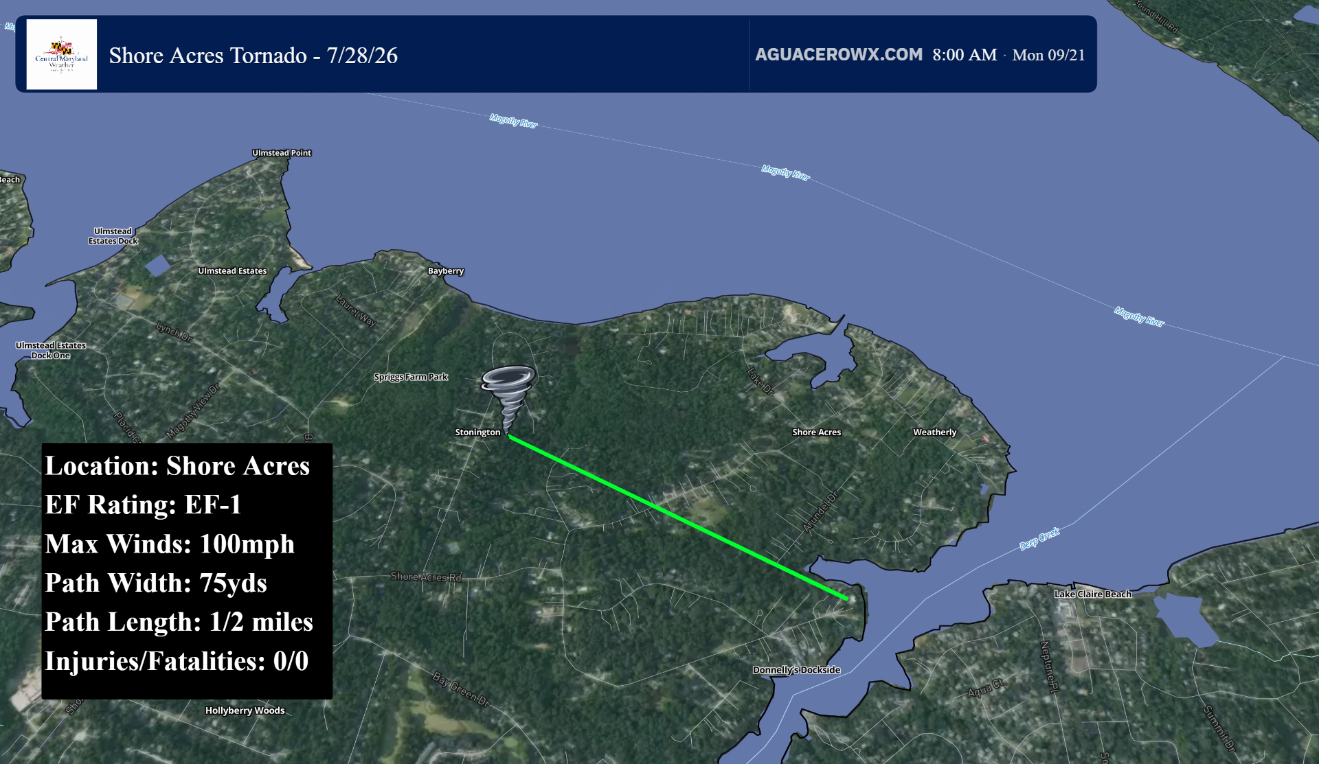
The third tornado touched down in Cape St. Claire at 6:17pm in a forested area just north of Shore Acres Rd. Here, several trees had their tops snapped off. The tornado continued to track generally ESE, resulting in severe tree damage along Lake Dr. This is where many hardwood trees that were otherwise healthy were toppled. Additionally, a garage door was completely blown in. No damage was found past this location, as the tornado dissipated around 6:19pm.
This tornado was also rated EF-1 with maximum winds of 100mph. It was on the ground for a half mile and was 75 yards wide.
