OTD in 2023: Severe weather outbreak across the mid atlantic
On the afternoon of August 7th, 2023, a rare level 4/5 moderate risk of severe weather was in place, as a powerful low pressure system intersected a highly unstable and unusually strongly sheared airmass over the Mid Atlantic. The parameters were highly unusual for this time of year, which led to multiple tornadoes as well as widespread destructive winds up to 100mph. All in all, this was the most impactful severe weather event for northern Maryland since the 2012 Super Derecho and Hurricane Sandy.
Damage Reports
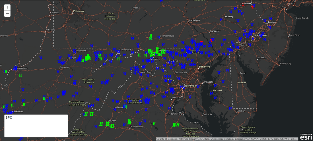
The first storm of the day was an intense supercell that tracked through Washington, Frederick, and Carroll counties. This storm produced winds up to 70mph and hail as large as SOFTBALLS, which is something seldom seen around here.
The main round of storms formed into an intense squall line packing embedded tornadoes as well as widespread damaging and in some cases destructive wind gusts. Hundreds of reports of trees and powerlines blown down were received, and some structural damage occured as well just from straight line winds alone! In fact, there were so many downed trees, the NWS couldn't map them all as you wouldn't be able to see the map below the reports...
Carroll county was hit especially hard, with thousands of trees blown down, roof and siding damage on homes, and dozens of snapped power lines that trapped cars and injured several people on Route 40 in Westminster. Power was out for more than half of the county which lasted several days in some areas. In downtown Westminster, winds were estimated to have reached 90-100mph based on the snapping of more than 30 power poles and thousands of trees being blown down.
At Carroll Community College, one Professor recalls water entering the windows of her classroom due to the force of the wind, estimated to be in the 60-70mph range on campus. Trees were also down on and near the College, which was without power for several days. The widespread hurricane force winds stretched further east through Manchester and Gamber into northern Baltimore county where thousands of more trees were downed, and at least one more person was injured by falling trees.
Dozens upon dozens of roads were closed for several days leading to substantial travel delays thanks to debris in the roadways.
Manchester Tornado
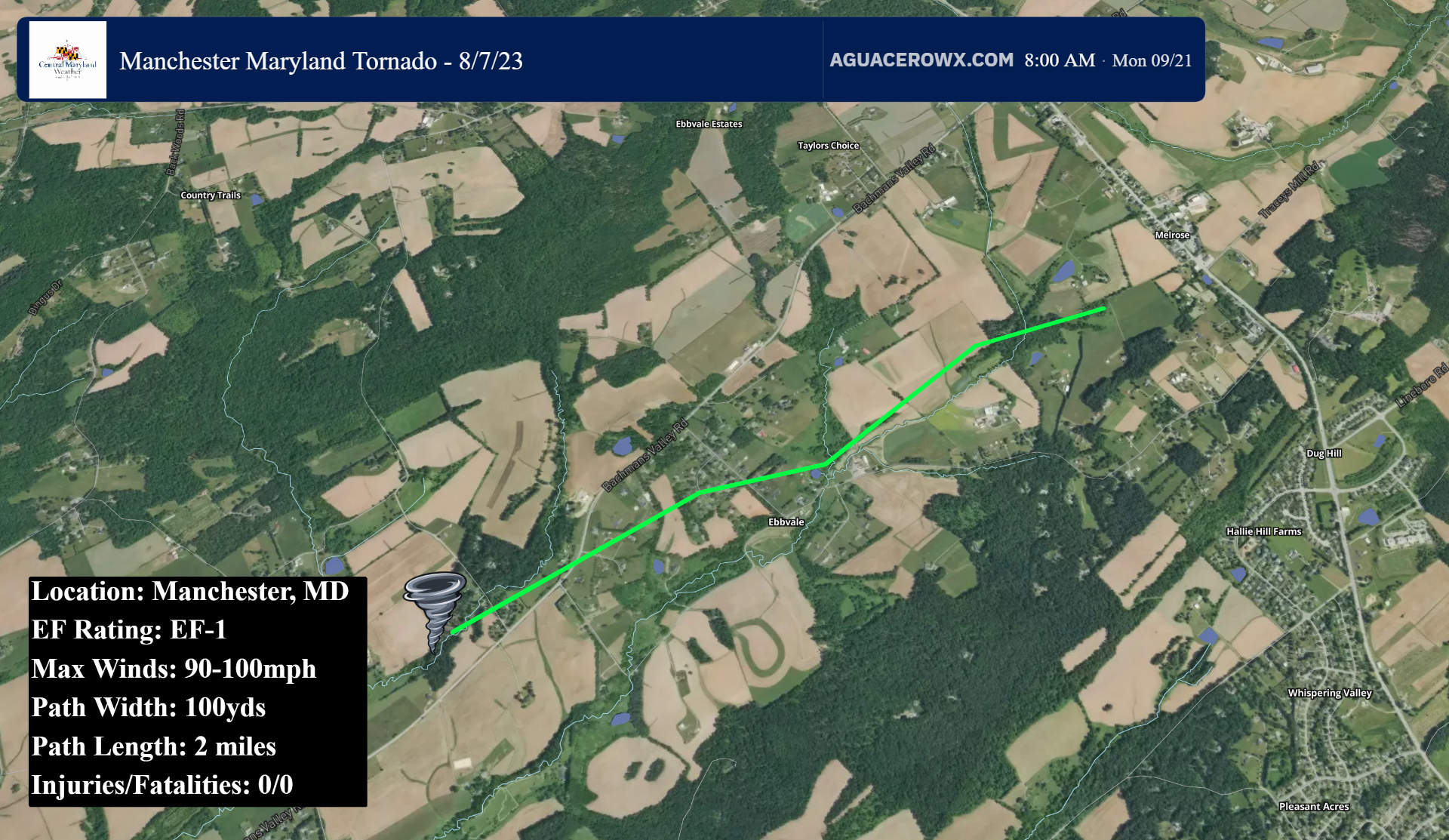
The first Maryland tornado touched down at the intersection of Wine Road and Bachmans Valley Road, where numerous large trees were snapped and uprooted in all directions except west. The tornado moved quickly to the northeast where it entered the White Oak Court subdivision. Here, it snapped more than a dozen pine trees. The tornado crossed Ebbvale Road, where additional pine trees were downed, before minor tree damage was noted in open farm fields alone Big Pipe Creek. The tornado then entered a wooded area, downing several more trees before lifting just prior to Maryland Route 30.
The National Weather Service chose not to survey/confirm this tornado, however the damage pattern and lofted debris shown on radar (debris was lofted to at least 6,000 feet into the air) clearly support the occurrence of a tornado. Based on the damage, the tornado likely would have been rated EF1 with 90-100mph winds.
Lineboro Tornado:
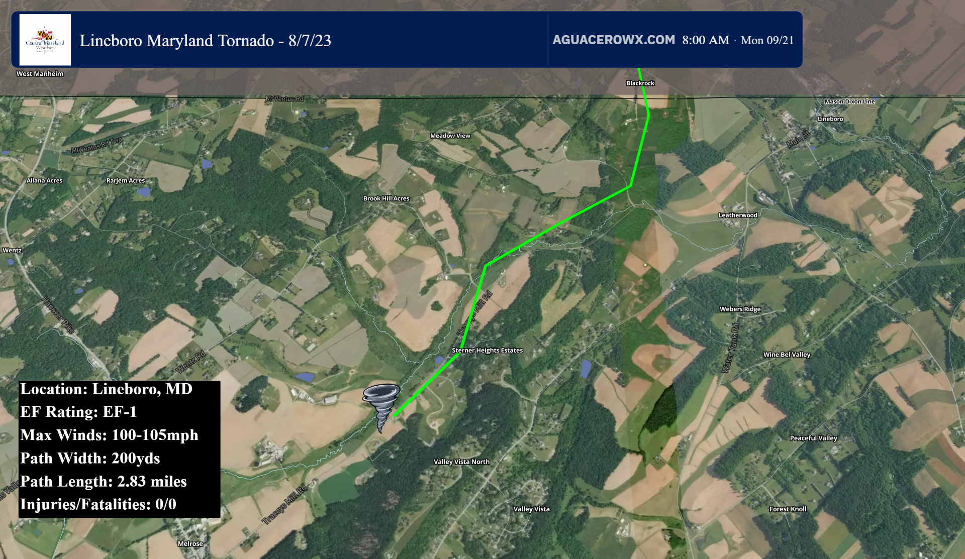
A second tornado touched down in Lineboro, tracking northeast into extreme southern York County in Pennsylvania. The tornado first touched down along Tracey's Mill Road 1 mile northeast of Maryland Route 30. Here, minor tree damage was noted where one tree fell perpendicular to the storms motion (Tree fell north, storm was moving east). Multiple trees were snapped and topped at varying levels between Tracey's Mill Road and Meadowview Drive, where a roof of a single family home sustained damage to its shingles.
The tornado continued to track generally NE winding along Tracey's Mill Road where it continued to snap and uproot trees in wooded areas along the road. The tornado turned north at the intersection of Tracey's Mill Road and Black Rock road. This is here it crossed into York County PA, snapping trees and severely damaging several outbuildings.
The National Weather Service in State College rated the Pennsylvania portion of the tornado as EF1 with maximum winds of 105mph. The National Weather Service in Sterling Virginia opted not to survey the damage in Carroll County, though the damage pattern, radar indicated lofting of debris, and NWS State College confirmation clearly indicates this was a tornado.
